Carroll Park in Baltimore, Maryland — The American Northeast (Mid-Atlantic)
Camp Carroll
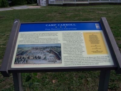
From Plantation to Federal Camp
This land was part of a 2,568-acre tract named Georgia Plantation, that Charles Carroll purchased in 1732. By 1760, his son Charles Carroll, a lawyer, had constructed a Georgian summer home, Mount Clare. the Carroll family lived here until 1852.
In April 1861, in the first bloodshed of the Civil War, a crowd of Confederate sympathizers in Baltimore attacked the 6th Massachusetts Infantry as it passed through the city en rout to Washington. By summer the U.S. Army had established camps throughout Baltimore. Brig. Gen. John Reese Kenly, of the Maryland militia, opened a recruiting office and a month later took command of the 1st Maryland Infantry as colonel. He converted the pastures to the west of Mount Clare, then a hotel, into a training facility named Camp Carroll.
On March 22, 1862 the U.S. Army created the Middle Department in Baltimore to protect rail and communication lines. Gen. James Cooper’s brigade, organized in April, including troops stationed here at Camp Carroll near the Baltimore and Ohio Railroad line. The brigade was disbanded on May 25, 1862. Units were trained here in drill, guard, and patrol duties. Officers may have been quartered in the Mount Clare Hotel, which offered an outstanding view of the camp. In the fall of 1862, Camp Carroll was renamed Camp Chesebrough, honoring Lt. Colonel William G. Chesebrough, 17th U.S. Infantry. In 1864 the name reverted to Camp Carroll. The camp remained in use by Federal forces until the war ended.
Erected by Maryland Civil War Trails.
Topics and series. This historical marker is listed in this topic list: War, US Civil. In addition, it is included in the Maryland Civil War Trails series list. A significant historical month for this entry is March 1639.
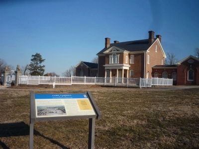
Location. This marker has been replaced by another marker nearby. It was located near 39° 16.746′ N, 76° 38.612′ W. Marker was in Baltimore, Maryland. It was in Carroll Park. Marker could be reached from Washington Boulevard. Marker is near the Mount Clare Mansion in Carroll Park. Touch for map. Marker was in this post office area: Baltimore MD 21230, United States of America. Touch for directions.
Other nearby markers. At least 8 other markers are within walking distance of this location. A different marker also named Camp Carroll (here, next to this marker); Mount Clare (a few steps from this marker); a different marker also named Mount Clare (within shouting distance of this marker); a different marker also named Mount Clare (within shouting distance of this marker); 1917 – 1918 (about 500 feet away, measured in a direct line); Joseph Beuys Tree Partnership (approx.
¼ mile away); Mount Clare, the Georgia Plantation (approx. ¼ mile away); Carroll Park (approx. ¼ mile away). Touch for a list and map of all markers in Baltimore.
Related marker. Click here for another marker that is related to this marker. This marker has been replaced with the linked marker.
Credits. This page was last revised on April 8, 2023. It was originally submitted on September 16, 2007, by Bill Pfingsten of Bel Air, Maryland. This page has been viewed 3,916 times since then and 31 times this year. Photos: 1. submitted on September 16, 2007, by Bill Pfingsten of Bel Air, Maryland. 2. submitted on April 1, 2011, by Richard E. Miller of Oxon Hill, Maryland. • J. J. Prats was the editor who published this page.

