Bar Harbor in Hancock County, Maine — The American Northeast (New England)
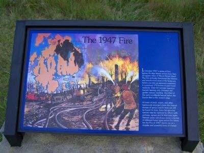
The 1947 Fire
A forest of birch, aspen, and other hardwoods emerged where the charred stumps of spruce and fir trees can still be found. In time, these fast-growing species may be replaced by others until, perhaps,, spruce and fir dominate again. Natural cycles will always create a mosaic of different forest types across the island, but the Fire of 1947 stands out as a singular and powerful force of change.
Topics. This historical marker is listed in this topic list: Disasters. A significant historical month for this entry is October 1947.
Location. 44° 23.06′ N, 68° 13.768′ W. Marker is in Bar Harbor, Maine, in Hancock County. Marker is on Paradise Hill Rd, on the left. Marker is in pull-off of Acadia National Park loop. Touch for map. Marker is in this post office area: Bar Harbor ME 04609, United States of America. Touch for directions.
Other nearby markers. At least 8 other markers are within 2 miles of this marker, measured as the crow flies. Signs of the Seasons (approx. one mile away); The Kedge (approx. 1.1 miles away); Holy Redeemer / Église de Holy Redeemer (approx. 1.1 miles away); Bar Island (approx. 1.1 miles away); The YWCA and Jesup Memorial Library / La YWCA et la bibliothèque Jesup (approx. 1.1 miles away); St. Saviour's Episcopal Parish Welcomes You (approx. 1.1 miles away); The Village Burying Ground (approx. 1.1 miles away); Civil War Memorial (approx. 1.2 miles away). Touch for a list and map of all markers in Bar Harbor.
Credits. This page was last revised on June 16, 2016. It was originally submitted on December 13, 2009, by Bill Pfingsten of Bel Air, Maryland. This page has been viewed 1,538 times since then and 11 times this year. Photos: 1, 2. submitted on December 13, 2009, by Bill Pfingsten of Bel Air, Maryland.

