Near Winchester in Frederick County, Virginia — The American South (Mid-Atlantic)
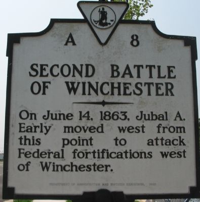
Second Battle of Winchester
Erected 1938 by Department of Conservation and Historic Resources. (Marker Number A-8.)
Topics and series. This historical marker is listed in this topic list: War, US Civil. In addition, it is included in the Virginia Department of Historic Resources (DHR) series list. A significant historical month for this entry is June 1862.
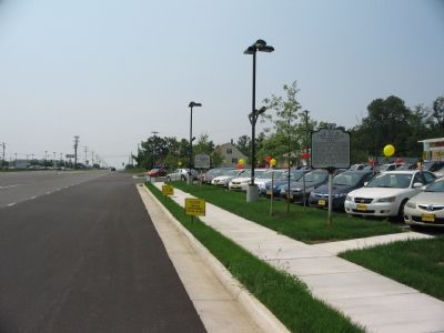
Location. 39° 7.202′ N, 78° 11.834′ W. Marker is near Winchester, Virginia, in Frederick County. Marker is at the intersection of Valley Pike (U.S. 11) and Prosperity Lane on Valley Pike. Touch for map. Marker is at or near this postal address: 3880 Valley Pike, Winchester VA 22602, United States of America. Touch for directions.
Other nearby markers. At least 8 other markers are within 2 miles of this marker, measured as the crow flies. First Battle of Winchester (a few steps from this marker); House of First Settler (approx. 0.8 miles away); First Battle of Kernstown (approx. 1.2 miles away); In Memory of the Many Soldiers of the Revolution (approx. 1.3 miles away); 1790 Stone Church (approx. 1.3 miles away); In Memory of William Hoge (1660 - 1749) and His Wife Barbara Hume Hoge (1670 - 1745) (approx. 1.4 miles away); Opequon Presbyterian Church (approx. 1.4 miles away); Kernstown Battles (approx. 1.4 miles away). Touch for a list and map of all markers in Winchester.
Also see . . . Second Battle of Winchester. National Parks summary of the battle. (Submitted on September 19, 2007, by Craig Swain of Leesburg, Virginia.)
Credits. This page was last revised on September 17, 2022. It was originally submitted on September 19, 2007, by Craig Swain of Leesburg, Virginia. This page has been viewed 1,579 times since then and 27 times this year. Photos: 1, 2, 3. submitted on September 19, 2007, by Craig Swain of Leesburg, Virginia. • J. J. Prats was the editor who published this page.


