Jonestown in Baltimore, Maryland — The American Northeast (Mid-Atlantic)
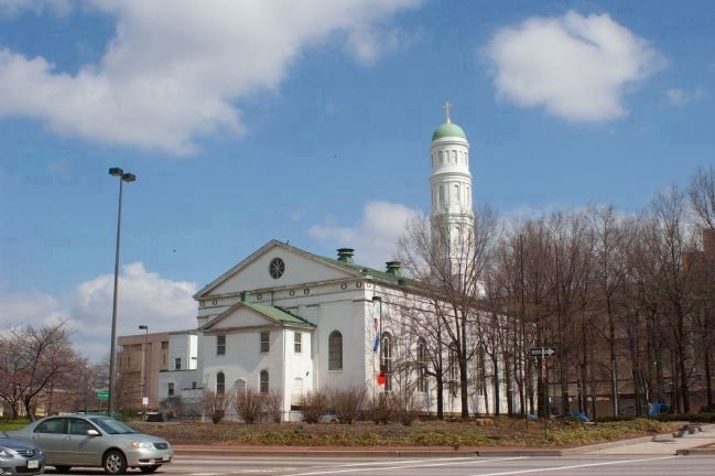
St. Vincent de Paul Church
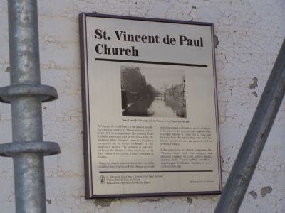
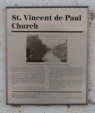
When the church was completed, the rear of the building faced the Jones Falls, then an open and turbulent stream and constant source of concern to the church, Its frequent and unpredictable rampages exacted a heavy toll in lives and property from the surrounding area until the stream was covered over and paved in 1911 to form the Fallsway.
A few years later the church inaugurated the “Printers Mass,” held after midnight and attended regularly by night workers nearby. Services at St. Vincent de Paul have been a popular part of Baltimore tradition for over a century and a half.
Erected by the City of Baltimore, St. Vincent de Paul Church Historic Trust Fund, Sponsor, William Donald Schaefer, mayor, rededicated 2005 by Martin O'Malley, mayor.
Topics and series. This historical marker is listed in these topic lists: Architecture • Churches & Religion • Landmarks • Waterways & Vessels. In addition, it is included in the Maryland, Baltimore City historical markers series list. A significant historical year for this entry is 1911.
Location. 39° 17.478′ N, 76° 36.352′ W. Marker is in Baltimore, Maryland. It is in Jonestown. Marker is at the intersection of North Front Street and Fayette Street, on the right when traveling south on North Front Street. Marker is near the sancturary door. Touch for map. Marker is in this post office area: Baltimore MD 21233, United States of America. Touch for directions.
Other nearby markers. At least 10 other markers are within walking distance of this marker. A different marker also named St. Vincent de Paul Church (a few steps from this marker); First Baptist Church, Baltimore (within shouting distance of this marker); Shot Tower (within shouting distance of this marker); Baltimore Police Department (about 300 feet away, measured in a direct line); 9 North Front Street (about 400 feet away); Veterans Park (about 500 feet away); German 170 MM. Minnewerfer (about 700 feet away); War Memorial (about 700 feet away); Baltimore's Great Fire (approx. 0.2 miles away); Fish Market (approx. 0.2 miles away). Touch for a list and map of all markers in Baltimore.
Also see . . . St. Vincent de Paul Church website. (Submitted on March 16, 2008, by Christopher Busta-Peck of Shaker Heights, Ohio.)
Credits. This page was last revised on August 28, 2020. It was originally submitted on September 19, 2007, by Bill Pfingsten of Bel Air, Maryland. This page has been viewed 3,101 times since then and 31 times this year. Photos: 1. submitted on September 19, 2007, by Bill Pfingsten of Bel Air, Maryland. 2. submitted on March 16, 2008, by Christopher Busta-Peck of Shaker Heights, Ohio. 3. submitted on September 19, 2007, by Bill Pfingsten of Bel Air, Maryland. 4. submitted on April 12, 2008, by Christopher Busta-Peck of Shaker Heights, Ohio. 5. submitted on March 16, 2008, by Christopher Busta-Peck of Shaker Heights, Ohio. • J. J. Prats was the editor who published this page.
