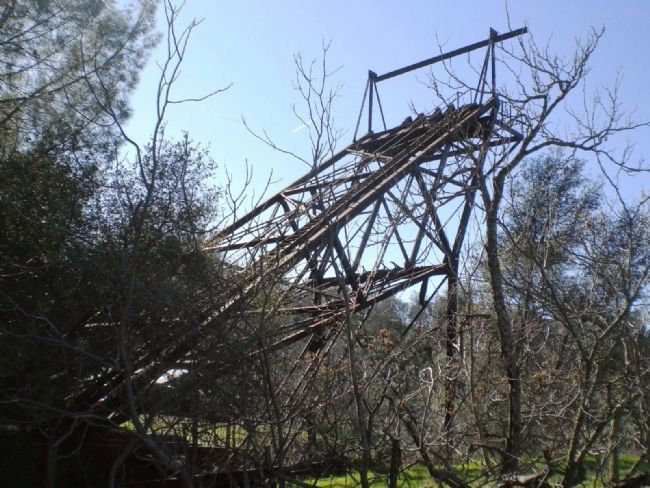
Amador City in Amador County, California — The American West (Pacific Coastal)
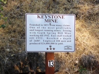
Keystone Mine
Erected 2004 by Amador County Sesquicentennial. (Marker Number 13.)
Topics. This historical marker is listed in this topic list: Industry & Commerce. A significant historical year for this entry is 1851.
Location. 38° 25.057′ N, 120° 49.423′ W. Marker is in Amador City, California, in Amador County. Marker can be reached from Main Street south of Water Street. Touch for map. Marker is in this post office area: Amador City CA 95601, United States of America. Touch for directions.
Other nearby markers. At least 8 other markers are within 2 miles of this marker, measured as the crow flies. Imperial Hotel (about 600 feet away, measured in a direct line); Original Amador Mine (approx. 0.2 miles away); Amador City Cemetery (approx. 0.2 miles away); South Spring Hill Mine (approx. 0.4 miles away); Bunker Hill Mine (approx. half a mile away); Treasure Mine (approx. 0.9 miles away); Fremont-Gover Mine (approx. 1.4 miles away); William Tucker's Fire Bell (approx. 1˝ miles away). Touch for a list and map of all markers in Amador City.
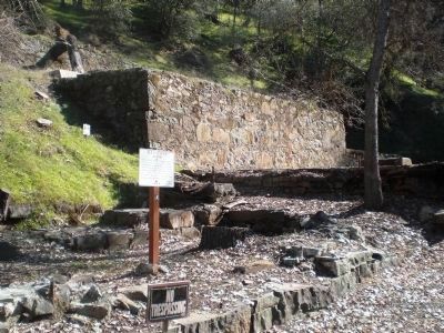
More about this marker. The marker is mounted on a pole amidst the ruins of the Keystone Mine. The ruins are located just a few steps south of the south end of the parking lot on the east side of Main Street (Old Highway 49).
Also see . . . Amadorgold's Keystone Mine Online Tour. Photo's and historic information on the Keystone Mine (Submitted on February 4, 2012, by Amador Gold of Jackson, California, Amador County.)
Photographed By Andrew Ruppenstein, June 28, 2008
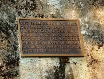
3. Additional Plaque Indicating Gifting of Mine Remains to Amador City.
On the ruins is attached a plaque reading: "Gift from Henry and Mary Garibaldi, to the city of Amador City, of the headframe, hoist, and boiler located at the Keystone Mine. In memory of Henry Garibaldi's parents, Theresa and Peter Garibaldi." Although this plaque indicates city ownership of at least some of the ruins, the mine is private property and Sutter Gold Mining Company, Inc. may someday attempt to again extract gold ore from the Keystone Mine property.
Photographed By Andrew Ruppenstein, January 31, 2009
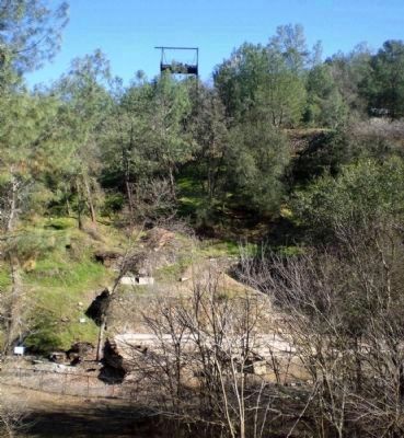
6. Keystone Mine Remains - View from West
This view shows the remains of the Keystone Mine, as seen from west of the mine. The headframe is at the top of the hill, while more remains are at the bottom of the hill, with the marker just visible on the left.
Credits. This page was last revised on September 26, 2020. It was originally submitted on December 30, 2009, by Andrew Ruppenstein of Lamorinda, California. This page has been viewed 2,140 times since then and 36 times this year. Photos: 1, 2. submitted on December 30, 2009, by Andrew Ruppenstein of Lamorinda, California. 3, 4, 5, 6, 7. submitted on December 31, 2009, by Andrew Ruppenstein of Lamorinda, California. • Syd Whittle was the editor who published this page.
