St. Matthews in Calhoun County, South Carolina — The American South (South Atlantic)
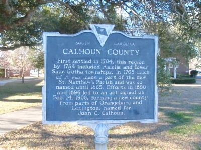
Calhoun County
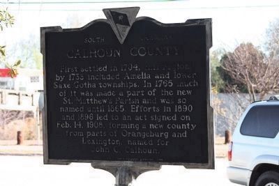
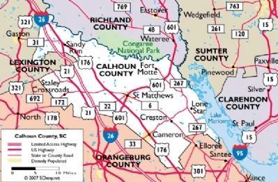
First settled in 1704, this region by 1733 included Amelia and lower Saxe Gotha townships. In 1765 much of it was made part of the new St. Matthew's Parish and was so named until 1865. Efforts in 1890 and 1896 led to an act signed on Feb. 14, 1908 forming a new county from parts of Orangeburg and Lexington, named for John C. Calhoun.
Erected 1958 by Calhoun County Historical Commission. (Marker Number 9-5.)
Topics and series. This historical marker is listed in these topic lists: Political Subdivisions • Settlements & Settlers. In addition, it is included in the South Carolina, Calhoun County Historical Commission/Society series list. A significant historical month for this entry is February 1930.
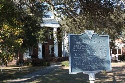
Location. 33° 39.793′ N, 80° 46.71′ W. Marker is in St. Matthews, South Carolina, in Calhoun County. Marker is at the intersection of South Railroad Avenue (State Highway 9-48) and Dantzier Street, on the right when traveling south on South Railroad Avenue. It is on the southeast side of the Calhoun County courthouse. Touch for map. Marker is in this post office area: Saint Matthews SC 29135, United States of America. Touch for directions.
Other nearby markers. At least 10 other markers are within 8 miles of this marker, measured as the crow flies. "Lest We Forget" (within shouting distance of this marker); Patriots of Calhoun County (within shouting distance of this marker); Tabernacle Cemetery (approx. 3.1 miles away); First Land Granted in Calhoun County Area (approx. 4.6 miles away); Honoring a Pioneer Woman (approx. 4.6 miles away); John Adam Treutlen (approx. 4.6 miles away); Miller Cemetery (approx. 6 miles away); St. Matthew's Lutheran Church (approx. 6.9 miles away); St. Matthew's Parish (approx. 7.1 miles away); Mount Pleasant Baptist Church (approx. 7.7 miles away). Touch for a list and map of all markers in St. Matthews.
Also see . . .
1. Calhoun County, South Carolina. Wikipedia entry:
Calhoun County is a county located in the U.S. state of South Carolina. (Submitted on February 10, 2011, by Brian Scott of Anderson, South Carolina.)
2. Calhoun County Courthouse. South Carolina Department of Archives and History website entry:
Calhoun County Courthouse was built in 1913 and designed by renowned South Carolina architect William Augustus Edwards. (Submitted on February 10, 2011, by Brian Scott of Anderson, South Carolina.)
3. A History of Amelia Township, South Carolina. The Known Towns / Villages of South Carolina website entry:
Amelia Township was established and first settled by German Lutherans in 1732. (Submitted on February 10, 2011, by Brian Scott of Anderson, South Carolina.)
4. A History of Saxe-Gotha Township, South Carolina. The Known Towns / Villages of South Carolina website entry:
One of the originals, Congaree Township, was renamed in 1735 to Saxe-Gotha Township and first settled by German Lutherans in that year. (Submitted on February 10, 2011, by Brian Scott of Anderson, South Carolina.)
5. John C. Calhoun. Wikipedia entry:
John Caldwell Calhoun (March 18, 1782 – March 31, 1850) was a leading politician and political theorist from South Carolina during the first half of the 19th century. (Submitted on February 10, 2011, by Brian Scott of Anderson, South Carolina.)
Additional commentary.
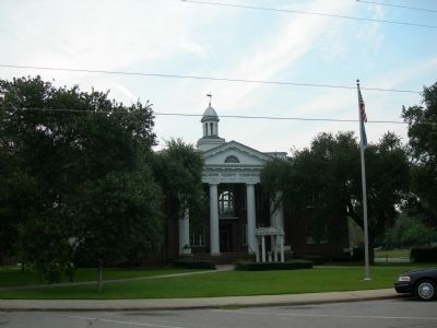
1. Calhoun County Courthouse
Calhoun County Courthouse was built in 1913. W.R. Rose was the contractor and William Augustus Edwards was the architect.
The courthouse is a two-story Georgian Revival building with a colossal Doric portico on the south elevation. The tetrastyle portico projects from a central three-bay entrance pavilion. The columns of the portico are of stuccoed brick with the proportion and detail of the Greek Doric order: no bases, the diameter broad in relation of the height, and annulets on the lower part of each capital echinus. The entablature of the portico is executed
in wood. It consists of a bipartite architrave, followed by a Doric frieze, with alternating triglyphs and metopes. A taenis beneath the triglyphs features wooden guttae. The triglyphs are spaced according to the tenets of the Roman Doric order, rather than those of the Greek; this, the terminal triglyphs are located above the centers of the terminal columns with a partial metope at the end of the frieze.
Significance
Calhoun County Courthouse was built to serve as the first courthouse of the new Calhoun County. The county, named for John C. Calhoun, renowned South Carolina statesman, had been formed after seventeen years of concerted effort by the residents of St. Matthews and its immediate surroundings. The act established the county and established a commission to provide for a courthouse and jail. The town of St. Matthews, designated the county seat, donated $20,000 toward construction costs for the public buildings and Mr. E.F. Buyck and Mr. M. Jarecky donated the construction site. (Source: National Register nomination form.)
— Submitted February 10, 2011, by Brian Scott of Anderson, South Carolina.
Credits. This page was last revised on June 14, 2022. It was originally submitted on January 24, 2009, by Mickey Ocean of Greenville County, South Carolina. This page has been viewed 1,500 times since then and 28 times this year. Last updated on December 31, 2009, by Mike Stroud of Bluffton, South Carolina. Photos: 1. submitted on January 24, 2009, by Mickey Ocean of Greenville County, South Carolina. 2. submitted on December 30, 2009, by Mike Stroud of Bluffton, South Carolina. 3. submitted on January 26, 2009, by Kevin W. of Stafford, Virginia. 4. submitted on December 29, 2009, by Mike Stroud of Bluffton, South Carolina. 5. submitted on February 13, 2011, by Brian Scott of Anderson, South Carolina. • Kevin W. was the editor who published this page.
