Old Fort Lowell in Tucson in Pima County, Arizona — The American Mountains (Southwest)
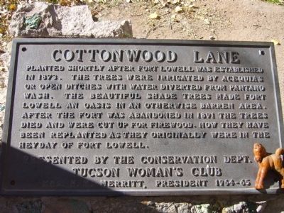
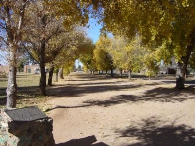
Cottonwood Lane
Tucson Womens Club
Mrs. H.M. Merritt, President 1964-65
Erected by The Conservation Dept., Tucson Womens Club.
Topics. This historical marker is listed in these topic lists: Forts and Castles • Horticulture & Forestry. A significant historical year for this entry is 1873.
Location. 32° 15.594′ N, 110° 52.411′ W. Marker is in Tucson, Arizona, in Pima County. It is in Old Fort Lowell. Marker can be reached from Cottonwood Lane near North Craycroft Road. Touch for map. Marker is at or near this postal address: 2900 N Craycroft Rd, Tucson AZ 85712, United States of America. Touch for directions.
Other nearby markers. At least 8 other markers are within walking distance of this marker. Fort Lowell (here, next to this marker); a different marker also named Fort Lowell (a few steps from this marker); Fort Lowell 1873-1891 / Post Hospital (within shouting distance of this marker); Veterans Memorial (within shouting distance of this marker); Post Hospital (within shouting distance of this marker); Infantry Barracks / Laundresses' Quarters (about 300 feet away, measured in a direct line); The Fort Lowell Flagstaff (about 400 feet away); Officers' Quarters (about 400 feet away). Touch for a list and map of all markers in Tucson.
More about this marker. The Marker is inside Fort Lowell Park.
Credits. This page was last revised on June 16, 2016. It was originally submitted on January 4, 2010, by Bill Kirchner of Tucson, Arizona. This page has been viewed 1,203 times since then and 22 times this year. Photos: 1, 2. submitted on January 4, 2010, by Bill Kirchner of Tucson, Arizona. • Syd Whittle was the editor who published this page.

