Near Winchester in Frederick County, Virginia — The American South (Mid-Atlantic)
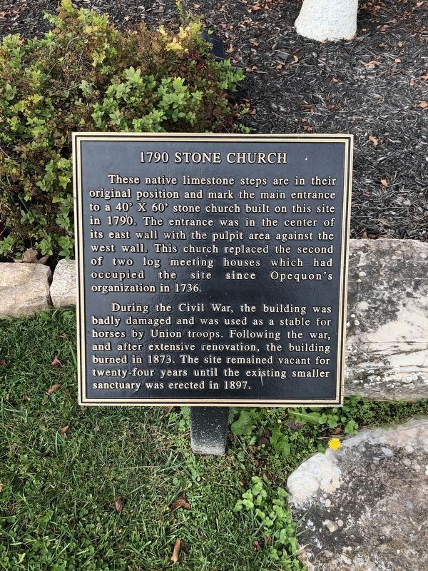
1790 Stone Church
These native limestone steps are in their original position and mark the main entrance to a 40' x 60' stone church built on this site in 1790. The entrance was in the center of its east wall with the pulpit area against the west wall. This church replaced the second of two log meeting houses which had occupied the site since Opequon's organization in 1736.
During the Civil War, the building was badly damaged and was used as a stable for horses by Union troops. Following the war, and after extensive renovation, the building burned in 1873. The site remained vacant for twenty-four years until existing smaller sanctuary was erected in 1897.
Topics. This historical marker is listed in these topic lists: Animals • Churches & Religion • Colonial Era • War, US Civil. A significant historical year for this entry is 1790.
Location. 39° 8.357′ N, 78° 11.72′ W. Marker is near Winchester, Virginia, in Frederick County. Marker is on Opequon Church Lane. Located on the east side of the church. Touch for map. Marker is at or near this postal address: 217 Opequon Church Lane, Winchester VA 22602, United States of America. Touch for directions.
Other nearby markers. At least 10 other markers are within walking distance of this marker. In Memory of the Many Soldiers of the Revolution (a few steps from this marker); In Memory of William Hoge (1660 - 1749) and His Wife Barbara Hume Hoge (1670 - 1745) (within shouting distance of this marker); Opequon Presbyterian Church (within shouting distance of this marker); Battle of Kernstown (about 300 feet away, measured in a direct line); a different marker also named Battle of Kernstown (about 300 feet away); Kernstown Battles (about 300 feet away); a different marker also named Battle of Kernstown (about 300 feet away); Second Battle of Kernstown (approx. ¼ mile away); The First Battle of Kernstown (approx. ¼ mile away); a different marker also named The Second Battle of Kernstown (approx. ¼ mile away). Touch for a list and map of all markers in Winchester.
Also see . . .
1. Opequon Presbyterian Church. Wikipedia entry (Submitted on July 8, 2022, by Larry Gertner of New York, New York.)
2. Opequon Presbyterian Church. Church website homepage (Submitted on September 21, 2007, by Craig Swain of Leesburg, Virginia.)

Photographed By Devry Becker Jones (CC0), October 31, 2020
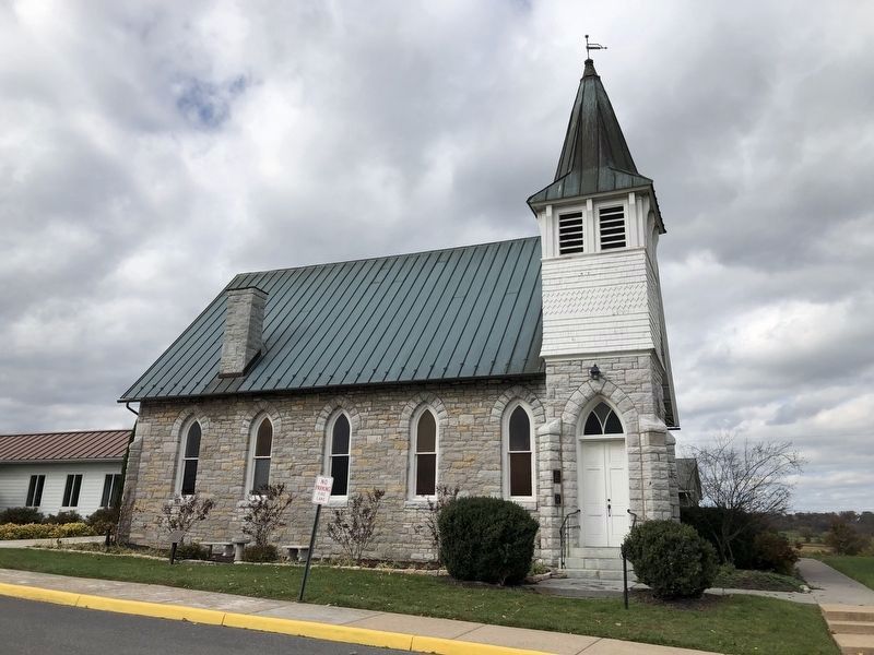
2. The stone church
The marker is on the left in front of the church building.

Photographed By Devry Becker Jones (CC0), October 31, 2020
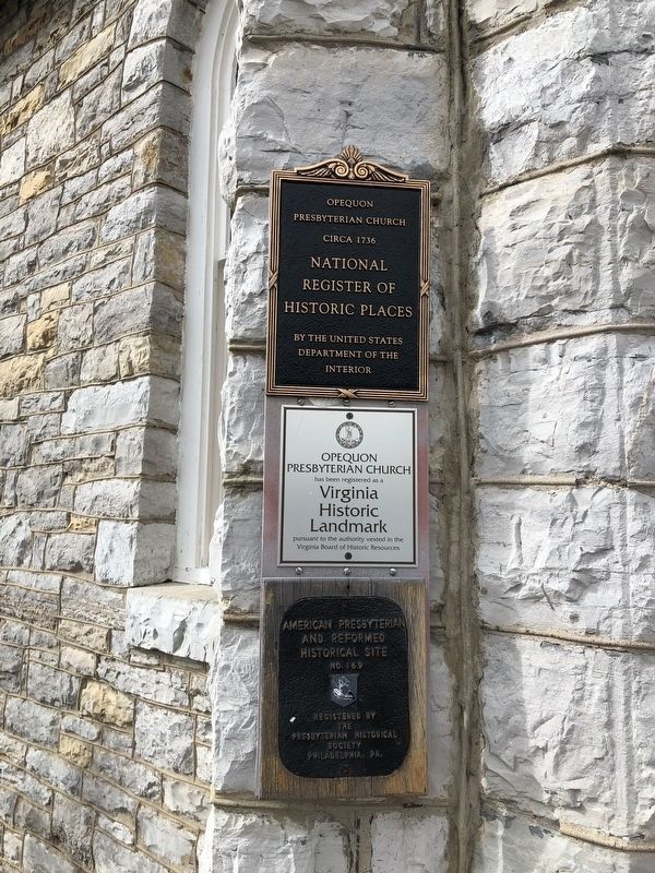
3. Additional plaques on the building
The plaques are for the church's status a location for inclusion of the National Register of Historic Places, the Virginia Historic Landmarks and the American Presbyterian and Reformed Historical Sites.
Credits. This page was last revised on July 8, 2022. It was originally submitted on September 21, 2007, by Craig Swain of Leesburg, Virginia. This page has been viewed 1,643 times since then and 43 times this year. Photos: 1, 2, 3. submitted on November 2, 2020, by Devry Becker Jones of Washington, District of Columbia. • J. J. Prats was the editor who published this page.
