Near Twin Falls in Twin Falls County, Idaho — The American West (Mountains)
Shoshone Falls Project
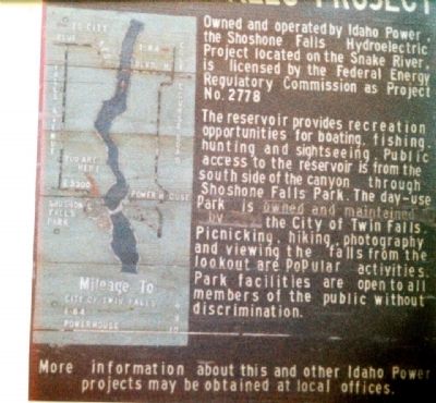
Owrned and operated by Idaho Power, the Shoshone Falls Hydroelectric Project located on the Snake River, is licensed by the Federal Energy Regulatory Commission as Project No. 2778.
The reservoir provides recreation opportunities for boating, fishing, hunting and sightseeing. Public access to the reservoir is from the south side of the canyon through Shoshone Falls Park. The day-use Park is owned and maintained by the City of Twin Falls. Picnicking, hiking, photography and viewing the falls from the lookout are popular activities. Park facilities are open to all members of the public without discrimination.
More information about this and other Idaho Power projects may be obtained at local offices.
Topics. This historical marker is listed in these topic lists: Industry & Commerce • Waterways & Vessels.
Location. 42° 35.431′ N, 114° 24.27′ W. Marker is near Twin Falls, Idaho, in Twin Falls County. Coordinates are approximate. Touch for map. Marker is in this post office area: Twin Falls ID 83301, United States of America. Touch for directions.
Other nearby markers. At least 8 other markers are within 3 miles of this marker, measured as the crow flies. Shoshone Falls (approx. ¼ mile away); Clarence Bisbee (approx. ¼ mile away); a different marker also named Shoshone Falls (approx. ¼ mile away); a different marker also named Shoshone Falls (approx. ¼ mile away); Before there were potatoes, there was GOLD (approx. 2.4 miles away); History Through the Eyes of a Camera (approx. 2.4 miles away); Snake River Canyon Gold Rush (approx. 2.4 miles away); Robert Evel Knievel (approx. 2.6 miles away). Touch for a list and map of all markers in Twin Falls.
Regarding Shoshone Falls Project. This is an indescribably gorgeous waterfall, 212 feet high.
Additional keywords. Shoshone Indians
Credits. This page was last revised on August 25, 2020. It was originally submitted on January 15, 2010, by Lila Diller of Statesville, North Carolina. This page has been viewed 1,222 times since then and 11 times this year. Photo 1. submitted on January 15, 2010, by Lila Diller of Statesville, North Carolina. • Kevin W. was the editor who published this page.
Editor’s want-list for this marker. Wide area picture of the marker and its surroundings. • Confirmation of location coordinates. • Can you help?
