Central Office District in Richmond, Virginia — The American South (Mid-Atlantic)
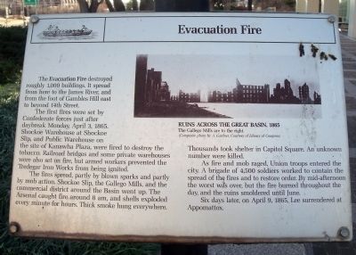
Evacuation Fire
The first tires were set by Confederate forces just after daybreak Monday April 3, 1865. Shockoe Warehouse at Shockoe Slip, and Public Warehouse on the site of Kanawha Plaza, were fired to destroy the tobacco. Railroad bridges and some private warehouses were also set on fire, but armed workers prevented the Tredegar Iron Works from being ignited.
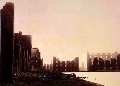
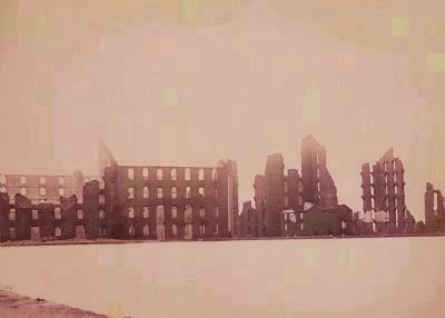
The fires spread, partly by blown sparks and partly by mob action. Shockoe Slip, the Gallego Mills, and the commercial district around the Basin went up. The Arsenal caught fire around 8 am, and shells exploded every minute for hours. Thick smoke hung everywhere. Thousands took shelter in Capitol Square. An unknown number were killed.
As fire and mob raged, Union troops entered the city. A brigade of 4,500 soldiers worked to contain the spread of the fires and to restore order. By mid-afternoon the worst was over, but the fire burned throughout the day, and the ruins smoldered until June.
Six days later, on April 9, 1865, Lee surrendered at Appomattox.
Topics. This historical marker is listed in these topic lists: Notable Events • War, US Civil. A significant historical date for this entry is April 3, 1800.
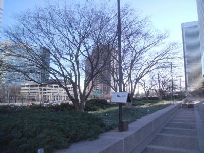
Location. 37° 32.268′ N, 77° 26.301′ W. Marker is in Richmond, Virginia. It is in the Central Office District. Marker can be reached from the intersection of East Cary Street and South 8th Street. This marker is located along the Dominion Building plaza. Touch for map. Marker is at or near this postal address: 701 East Cary Street, Richmond VA 23219, United States of America. Touch for directions.
Other nearby markers. At least 8 other markers are within walking distance of this marker. Evacuation of Richmond (here, next to this marker); Downtown Richmond Millsites (within shouting distance of this marker); Basin Race (within shouting distance of this marker); Kanawha Plaza (about 400 feet away, measured in a direct line); Canal Walk (about 400 feet away); The First National Bank Building (about 500 feet away); Richmond Evacuation Fire (about 600 feet away); Great Turning Basin (about 800 feet away). Touch for a list and map of all markers in Richmond.
More about this marker. On the upper right is a period photo of the "Ruins Across the Great Basin, 1865." with the caption, "The Gallego Mills are to the right. (Composite photo by A. Gardner, Courtesy of Library of Congress)"
Also see . . .
1. Reaction to the Fall of Richmond. American Battlefield Trust (Submitted on January 18, 2010.)
2. America’s Civil War: The Fall of Richmond. Historynet (Submitted on January 18, 2010.)
3. Fall of Richmond. Civil War Richmond (Submitted on January 18, 2010.)
4. James River and Kanawha Canal Historic District. National Register of Historic Places (Submitted on January 18, 2010.)
Credits. This page was last revised on February 1, 2023. It was originally submitted on January 18, 2010, by Bernard Fisher of Richmond, Virginia. This page has been viewed 1,043 times since then and 26 times this year. Photos: 1, 2, 3, 4. submitted on January 18, 2010, by Bernard Fisher of Richmond, Virginia.


