Washington Township near Morrow in Warren County, Ohio — The American Midwest (Great Lakes)
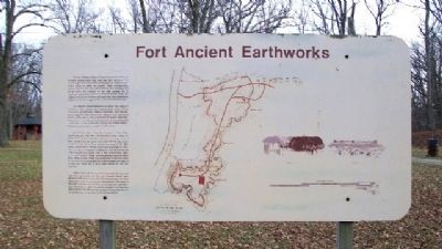
Fort Ancient Earthworks
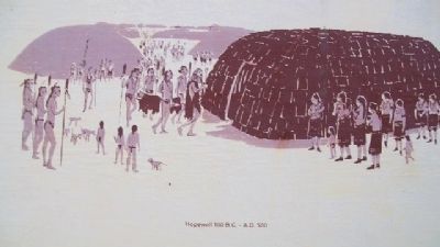
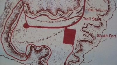
You are standing inside a hilltop earthworks built by the Hopewell Indians nearly 2000 years ago. Early settlers in this area thought these walls were constructed for defensive purposes, hence the name Fort Ancient. Today, archaeologists believe that this site was used primarily as a religious and social center. The evidence for this idea includes the 70 openings or gateways in the 3 1/2 miles of earthen walls. The presence of mounds, parallel earth walls, and stone pavements at Fort Ancient also suggests that it was not a defensive site.
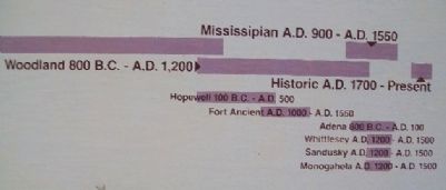
The Hopewell Indians occupied the major river valleys of southern Ohio, where they constructed other hilltop enclosures, geometrically shaped earthworks, and mounds. Archaeologists debate whether the Hopewell lived year-round at their earthworks, or only visited them for special occasions. Purposes for such special visits may have included additional construction on the earthworks, trading with distant communities, and participation in religious observances.
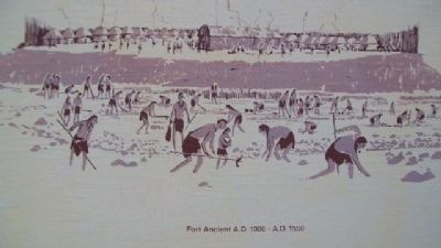
For reasons still unclear, the Hopewell culture disappeared after A.D.500-600. Late Woodland Indians, likely the descendents of the Hopewell, continued to occupy southern Ohio. The second major group associated with this site, known as the Fort Ancient Indians, settled here around A.D.1200. These people lived in villages which were supported by growing corn, beans, and squash in addition to hunting, fishing, and collecting wild plant foods. One of their communities, today known as Anderson Village, was located along the Little Miami River, while another village was established within the South Fort portion of the enclosure. Fort Ancient people were able to occupy one village for 10 to 15 years before the soil was depleted.
Archaeological techniques have improved with time, and each new dig reveals new data and theories. Recent work focuses on the sequence in which the Hopewell built the three major parts of the enclosure, and the possibility that some of the walls and mounds function as astronomical calendars. More information on Fort Ancient is available in the museum and along the trails. Please help us preserve this important site by walking only on the trails, not on the earthworks.
Erected by The Ohio Historical Society.
Topics and series. This historical marker is listed in these topic lists: Agriculture • Forts and Castles • Native Americans • Settlements & Settlers. In addition, it is included in the National Historic Landmarks series list. A significant historical year for this entry is 2000.
Location. 39° 23.974′ N, 84° 5.651′ W. Marker is near Morrow, Ohio, in Warren
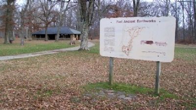
County. It is in Washington Township. Marker is about 300 feet west of the main picnic shelter on Fort Ancient State Memorial, near the park access road. Touch for map. Marker is at or near this postal address: 6123 OH-350, Oregonia OH 45054, United States of America. Touch for directions.
Other nearby markers. At least 8 other markers are within walking distance of this marker. The Great Gateway (within shouting distance of this marker); Changes at Fort Ancient (within shouting distance of this marker); Fort Ancient (within shouting distance of this marker); The Civilian Conservation Corps (about 300 feet away, measured in a direct line); Earthworks Trail (about 400 feet away); The Myth of the Mound Builders (approx. 0.2 miles away); Fort Ancient Dwelling (approx. 0.2 miles away); Stages of Construction / Crescent Mounds (approx. 0.2 miles away). Touch for a list and map of all markers in Morrow.
Regarding Fort Ancient Earthworks. UNESCO inscribed the Hopewell Ceremonial Earthworks as a World Heritage Site on September 19, 2023, comprising the park and related sites.
Also see . . .
1. Fort Ancient Earthworks. Ohio History Central website entry (Submitted on January 19, 2010, by William Fischer, Jr. of Scranton, Pennsylvania.)
2. Fort Ancient State Memorial. Ohio State Parks website entry (Submitted on July 24, 2022, by Larry Gertner of New York, New York.)
Credits. This page was last revised on January 21, 2024. It was originally submitted on January 19, 2010, by William Fischer, Jr. of Scranton, Pennsylvania. This page has been viewed 1,231 times since then and 26 times this year. Photos: 1, 2, 3, 4, 5, 6, 7, 8. submitted on January 19, 2010, by William Fischer, Jr. of Scranton, Pennsylvania.
