Birmingham in Jefferson County, Alabama — The American South (East South Central)
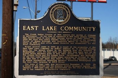
East Lake Community
Major growth came in 1886 as a result of the promotion of the East Lake Land Company by Robert Jemison Sr. to provide housing sites for the miners drawn to the booming iron ore industry in Birmingham. Lots 50 feet wide and 180 feet long were laid out on 2,000 acres between what is now 69th Street to 85th Street and 5th Avenue North and 5th Avenue South. Development was dependent on the East Lake Railroad which began operating on October 8, 1887. On this site a car barn was built to house the equipment of the 21 steam locomotives operating between downtown Birmingham and the East Lake terminus at 83rd Street.
The town of East Lake was incorporated December 13, 1900. As a result of the street car the business district developed rapidly. On January 1, 1910 East Lake was incorporated into the City of Birmingham but it has remained a distinctive community.
Erected 1992 by Alabama Historical Commission / City of Birmingham and the South East Lake Neighborhood Association.
Topics and series. This historical marker is listed in these topic lists: Government & Politics • Native Americans • Notable Places • Railroads & Streetcars • Settlements & Settlers. In addition, it is included in the Alabama Historical Commission series list. A significant historical month for this entry is January 1886.
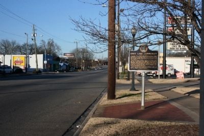
Location. 33° 33.708′ N, 86° 43.716′ W. Marker is in Birmingham, Alabama, in Jefferson County. Marker is on 1st Avenue North (U.S. 11), on the right when traveling north. Touch for map. Marker is at or near this postal address: 7701 1st Avenue North, Birmingham AL 35206, United States of America. Touch for directions.
Other nearby markers. At least 8 other markers are within 2 miles of this marker, measured as the crow flies. Howard College (approx. ¼ mile away); Ruhama Baptist Church (approx. 0.4 miles away); CDR "Snuffy" Smith (approx. half a mile away); East Lake Park (approx. 0.6 miles away); 1963 Church Bombing Victims (approx. 1½ miles away); Forrest Camp No. 1435 (approx. 1½ miles away); United Confederate Veterans (approx. 1½ miles away); History of the 117th Tactical Reconnaissance Wing (approx. 1.8 miles away). Touch for a list and map of all markers in Birmingham.
Credits. This page was last revised on August 28, 2020. It was originally submitted on January 20, 2010, by Timothy Carr of Birmingham, Alabama. This page has been viewed 2,196 times since then and 158 times this year. Photos: 1, 2. submitted on January 20, 2010, by Timothy Carr of Birmingham, Alabama. • Bill Pfingsten was the editor who published this page.

