Washington Township near Morrow in Warren County, Ohio — The American Midwest (Great Lakes)
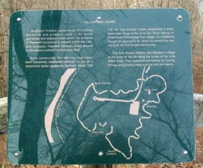
Hilltop Enclosure
Hopewell Indians constructed this hilltop enclosure and probably used it for social gatherings and religious observances. No evidence of Hopewell occupation is present within the 100+ acre enclosure. Hopewell domestic areas abound on the plateau outside the enclosure itself.
Once constructed, the site may have never been completely abandoned although its use as a ceremonial center apparently declined. About 1000 A.D. the Fort Ancient Indians established a small, stockaded village in the south fort. When Warren K. Moorehead investigated this village, he mistakenly thought its occupants for whom he named the site, had built the Fort Ancient earthworks.
The Fort Ancient Indians also founded a village at the base of the hill along the banks of the Little Miami River. They supported themselves by hunting, fishing, and growing crops such as corn and beans.
Erected by The Ohio Historical Society.
Topics. This historical marker is listed in these topic lists: Forts and Castles • Man-Made Features • Native Americans • Natural Features • Notable Places.
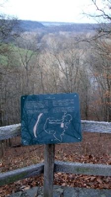
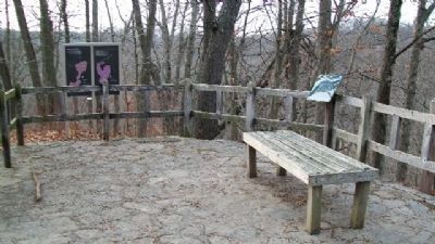
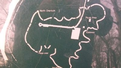
Location. 39° 24.022′ N, 84° 5.873′ W. Marker is near Morrow, Ohio, in Warren County. It is in Washington Township. Marker is at the South Fort's North Overlook on Fort Ancient State Memorial. Touch for map. Marker is at or near this postal address: 6123 Ohio Route 350, Oregonia OH 45054, United States of America. Touch for directions.
Other nearby markers. At least 8 other markers are within walking distance of this marker. North Overlook (here, next to this marker); Fort Ancient Prehistoric Indian Earthworks (within shouting distance of this marker); The Myth of the Mound Builders (about 300 feet away, measured in a direct line); Fort Ancient Dwelling (about 300 feet away); The Great Gateway (approx. 0.2 miles away); Fort Ancient Earthworks (approx. 0.2 miles away); Changes at Fort Ancient (approx. 0.2 miles away); Earthworks Trail (approx. ¼ mile away). Touch for a list and map of all markers in Morrow.
Also see . . .
1. Fort Ancient Earthworks. Ohio History Central website entry (Submitted on January 25, 2010, by William Fischer, Jr. of Scranton, Pennsylvania.)
2. Fort Ancient State Memorial. Ohio State Parks website entry (Submitted on July 24, 2022, by Larry Gertner of New York, New York.)
Credits. This page was last revised on February 6, 2023. It was originally submitted on January 25, 2010, by William Fischer, Jr. of Scranton, Pennsylvania. This page has been viewed 823 times since then and 13 times this year. Photos: 1, 2, 3, 4. submitted on January 25, 2010, by William Fischer, Jr. of Scranton, Pennsylvania.


