Oglethorpe in Macon County, Georgia — The American South (South Atlantic)
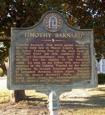
Timothy Barnard
Erected 1955 by Georgia Historical Commission. (Marker Number 096-2.)
Topics and series. This historical marker is listed in these topic lists: Colonial Era • Native Americans • Roads & Vehicles • Settlements & Settlers. In addition, it is included in the Georgia Historical Society series list. A significant historical year for this entry is 1820.
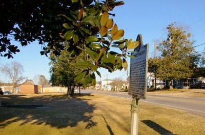
Location. 32° 17.55′ N, 84° 3.771′ W. Marker is in Oglethorpe, Georgia, in Macon County. Marker is at the intersection of Chatham Street (Georgia Route 49) and N. Randolph Street, on the right when traveling south on Chatham Street. Touch for map. Marker is in this post office area: Oglethorpe GA 31068, United States of America. Touch for directions.
Other nearby markers. At least 8 other markers are within 8 miles of this marker, measured as the crow flies. Macon County (approx. 0.2 miles away); Lumpkin Academy (approx. ¼ mile away); Confederate Soldiers Monument (approx. 2.3 miles away); Mt. Zion Lutheran Church (approx. 5.9 miles away); The Unknown Soldier (approx. 7.3 miles away); Memorial to American Former Prisoners of War Stalag XVII-B (approx. 7.3 miles away); The Raiders' Graves (approx. 7.4 miles away); In Memory of ... (approx. 7.4 miles away). Touch for a list and map of all markers in Oglethorpe.
Credits. This page was last revised on January 31, 2020. It was originally submitted on February 4, 2010, by David Seibert of Sandy Springs, Georgia. This page has been viewed 1,076 times since then and 41 times this year. Photos: 1, 2. submitted on February 4, 2010, by David Seibert of Sandy Springs, Georgia. • Craig Swain was the editor who published this page.

