Independence in Jackson County, Missouri — The American Midwest (Upper Plains)
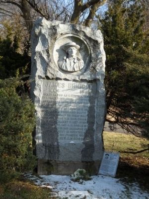
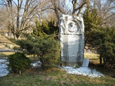
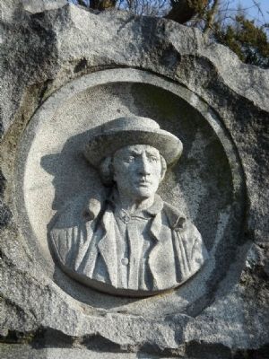
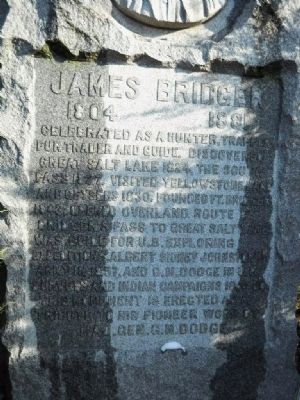
James Bridger Gravesite
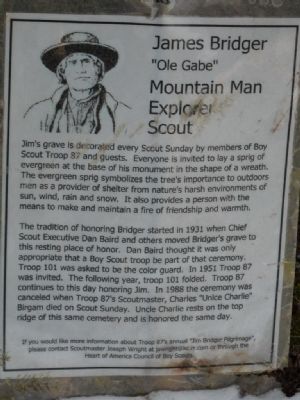
picture of Jim Bridger
1804 · 1881
Boy Scout Laminated Sheet
"Old Gabe"
Mountain Man
Explorer
Scout
Jim's grave is decorated every Scout Sunday by members of Boy Scout Troop 87 and guests. Everyone is invited to lay a spring of evergreen at the base of his monument in the shape of a wreath. The evergreen sprig symbolizes the tree's importance to outdoors men as a provider of shelter from nature's harsh environments of sun, wind, rain, and snow. It also provides a person with the means to make and maintain a fire of friendship and warmth. The tradition of honoring Bridger started in 1931 when Chief Scout Executive Dan Baird and others moved Bridger's grave to this resting place of honor. Dan Baird thought it was only appropriate that a Boy Scout troop be part of the ceremony. Troop 101 was asked to be the color guard. In 1951 Troop 87 was invited. The following year, Troop 101 folded. Troop 87 continues to this day honoring Jim. In 1988 the ceremony was canceled when Troop 87's Scoutmaster, Charles "Uncle Charlie" Birgam died on Scout Sunday. Uncle Charlie rests on the top ridge of this same cemetery and is honored the same day.
Erected by Major General Glenville M. Dodge.
Topics. This historical marker is listed in these topic lists: Cemeteries & Burial Sites • Exploration • Settlements & Settlers. A significant historical year for this entry is 1804.
Location. 39° 5.888′ N, 94° 28.194′ W. Marker is in Independence, Missouri, in Jackson County. Marker can be reached from Cemetery Road, 0.4 miles Winner Road, on the left when traveling west. Touch for map. Marker is at or near this postal address: 614 S Brookside Avenue, Independence MO 64053, United States of America. Touch for directions.
Other nearby markers. At least 8 other markers are within 3 miles of this marker, measured as the crow flies. Mount Washington Cemetery Bridge Facts (about 500 feet away, measured in a direct line); William Rockhill Nelson Chapel (approx. 0.3 miles away); Hill Farm & Cemetery (approx. 1.3 miles away); Sugar Creek Veteran's Memorial (approx. 1˝ miles away); Woodson House (approx. 2 miles away); Battle Line at Railroad Cut (approx. 2.2 miles away); F.M. Smith Study (approx. 2.2 miles away); Flournoy House (approx. 2.2 miles away). Touch for a list and map of all markers in Independence.
More about this marker. This headstone is on an "island" where the main Cemetery Road forks. The headstone itself is tucked into some cedar trees and bushes. The cemetery roads are paved and are fairly wide.
Also see . . .
1. James Bridger. Wikipedia entry (Submitted on February 6, 2010, by Thomas Onions of Olathe, Kansas.)
2. Heart of America Council. Link to the local Council of the Boy Scouts of America (Submitted on February 6, 2010, by Thomas Onions of Olathe, Kansas.)
Credits. This page was last revised on June 13, 2022. It was originally submitted on February 6, 2010, by Thomas Onions of Olathe, Kansas. This page has been viewed 2,452 times since then and 45 times this year. Photos: 1, 2, 3, 4, 5. submitted on February 6, 2010, by Thomas Onions of Olathe, Kansas. • Craig Swain was the editor who published this page.
