Hampton Township near Newton in Sussex County, New Jersey — The American Northeast (Mid-Atlantic)
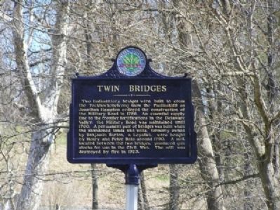
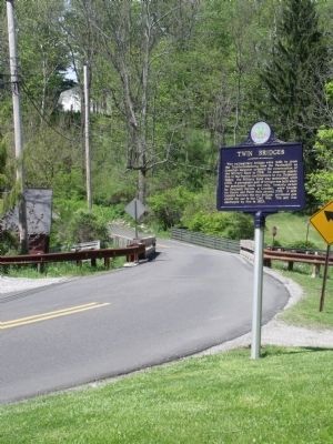
Twin Bridges
Erected 2002 by Sussex County Board of Chosen Freeholders and Sussex County Historic Marker Committee.
Topics and series. This historical marker is listed in these topic lists: Bridges & Viaducts • Colonial Era • Roads & Vehicles • War, US Civil. In addition, it is included in the New Jersey, Sussex County Board of Chosen Freeholders series list. A significant historical year for this entry is 1756.
Location. 41° 6.174′ N, 74° 45.522′ W. Marker is near Newton, New Jersey, in Sussex County. It is in Hampton Township. Marker is on Halsey Road (County Route 626). Touch for map. Marker is in this post office area: Newton NJ 07860, United States of America. Touch for directions.
Other nearby markers. At least 8 other markers are within 4 miles of this marker, measured as the crow flies. Sussex County Public Safety Memorial (approx. 1.3 miles away); Augusta Hill Baptists (approx. 1.9 miles away); Unknown Soldier of the Revolution (approx. 2.2 miles away); Sussex Railroad (approx. 3.1 miles away); Sussex County Veterans Memorial (approx. 3.1 miles away); Newton Green (approx. 3.1 miles away); Sussex County (approx. 3.1 miles away); a different marker also named Newton Green (approx. 3.1 miles away). Touch for a list and map of all markers in Newton.
Credits. This page was last revised on February 7, 2023. It was originally submitted on February 8, 2010, by Cheryl (Rome) Thom of Newton, New Jersey. This page has been viewed 1,742 times since then and 134 times this year. Photos: 1. submitted on February 8, 2010, by Cheryl (Rome) Thom of Newton, New Jersey. 2. submitted on May 13, 2010, by Cheryl (Rome) Thom of Newton, New Jersey. • Craig Swain was the editor who published this page.

