Kells in County Meath, Leinster, Ireland — Mid-East (and Dublin)
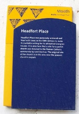
Headfort Place
Kells Heritage Trail
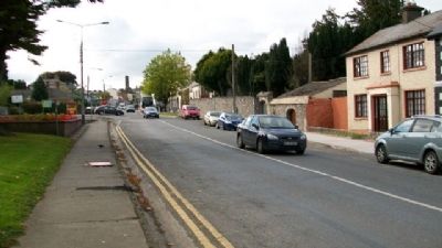
Headfort Place was purposely widened and lined with trees in the 18th century to make it a suitable setting for its attractive Georgian houses. It is also here that a site for a parish church was donated to the Roman Catholic community by Lord Bective. The original site of the church is in the area near the present church's carpark.
Erected by Meath Tourism.
Topics. This historical marker is listed in these topic lists: Charity & Public Work • Churches & Religion • Man-Made Features • Notable Places • Settlements & Settlers.
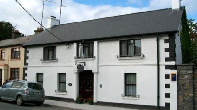
Location. 53° 43.61′ N, 6° 52.334′ W. Marker is in Kells, Leinster, in County Meath. Marker is on Headfort Place (Local Road 163) 0 kilometers east of Navan Road (National Road 3), on the right when traveling west. Marker is on the wall of the White Gables Bed & Breakfast. Touch for map. Touch for directions.
Other nearby markers. At least 8 other markers are within 3 kilometers of this marker, measured as the crow flies. Kells Courthouse (within shouting distance of this marker); Market Cross (within shouting distance of this marker); St Columba's Church (approx. 0.4 kilometers away); Suffolk Street (approx. half a kilometer away); The Churchyard Wall (approx. half a kilometer away); Catherine Dempsey (approx. 0.6 kilometers away); Kells Round Tower (approx. 0.6 kilometers away); Spire of Loyd (approx. 2.3 kilometers away). Touch for a list and map of all markers in Kells.
Credits. This page was last revised on August 16, 2017. It was originally submitted on February 9, 2010, by William Fischer, Jr. of Scranton, Pennsylvania. This page has been viewed 1,199 times since then and 11 times this year. Photos: 1, 2, 3. submitted on February 9, 2010.


