Clayton in Contra Costa County, California — The American West (Pacific Coastal)
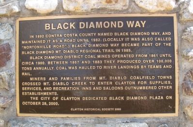
Black Diamond Way
Black Diamond District coal mines operated from 1861 until circa 1900. Between 1867 and 1883 they produced over 100,000 tons annually. Coal was hauled to river landings by teams and rail.
Miners and families from Mt. Diablo coalfield towns crossed Mt. Diablo Creek for supplies, services, and recreation. Inns and saloons outnumbered other establishments.
The City of Clayton dedicated Black Diamond Plaza on October 28, 2000.
Clayton Historical Society 2005
Erected 2005 by Clayton Historical Society.
Topics. This historical marker is listed in these topic lists: Industry & Commerce • Roads & Vehicles. A significant historical month for this entry is October 1851.
Location. 37° 56.47′ N, 121° 56.01′ W. Marker is in Clayton, California, in Contra Costa County. Marker is at the intersection of Marsh Creek Road and Main Street, on the right on Marsh Creek Road. Touch for map. Marker is in this post office area: Clayton CA 94517, United States of America. Touch for directions.
Other nearby markers. At least 8 other markers are within walking distance of this marker. Nan Joy & Lawrence “Joe” Wallace Fountain (within shouting distance of this marker); The Eucalyptus Grove (about 300 feet away, measured in a direct line); The Growler Saloon – Goethals Building (about 300 feet away); The Clayton Post Office (about 400 feet away); The Joel Clayton House (about 400 feet away); Clayton Museum Educational Garden (about 400 feet away); Farming & Ranching in Clayton (about 400 feet away); Joaquin Murrieta (about 400 feet away). Touch for a list and map of all markers in Clayton.
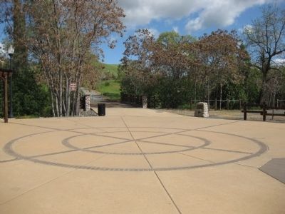
More about this marker. The marker is mounted on a stone monument on the east side of the plaza, at the start of Black Diamond Way.
Additional keywords. mining
Credits. This page was last revised on September 14, 2020. It was originally submitted on February 13, 2010, by Andrew Ruppenstein of Lamorinda, California. This page has been viewed 1,341 times since then and 24 times this year. Photos: 1, 2, 3. submitted on February 13, 2010, by Andrew Ruppenstein of Lamorinda, California. • Syd Whittle was the editor who published this page.


