Marker Logo HMdb.org THE HISTORICAL
MARKER DATABASE
“Bite-Size Bits of Local, National, and Global History”
Harvings Crossroads in Sumter County, South Carolina — The American South (South Atlantic)
 

Enon Baptist Church


Enon Baptist Church Marker image. Click for full size.
Photographed By Mike Stroud, 2010
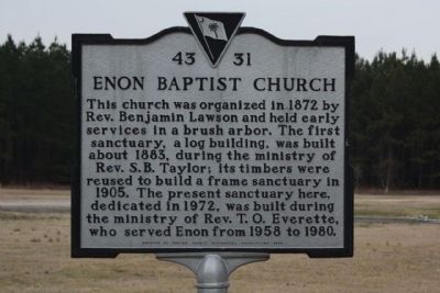
1. Enon Baptist Church Marker
Inscription. This church was organized in 1872 by Rev. Benjamin Lawson and held early services in a brush arbor. The first sanctuary, a log building, was built about 1883, during the ministry of Rev. S.B.Taylor; its timbers were reused to build a frame sanctuary in 1905. The present sanctuary here, dedicated in 1972, was built during the ministry of Rev. T.O. Everette, who served Enon from 1958 to 1980.
 
Erected 2000 by The Sumter County Historical Association. (Marker Number 43-31.)
 
Topics. This historical marker is listed in this topic list: Churches & Religion. A significant historical year for this entry is 1872.
 
Location. 33° 50.081′ N, 80° 26.324′ W. Marker is in Harvings Crossroads, South Carolina, in Sumter County. Marker is at the intersection of Starks Ferry Road and Pinewood Road (State Road 120), on the right when traveling west on Starks Ferry Road. Touch for map. Marker is in this post office area: Sumter SC 29154, United States of America. Touch for directions.
 
Other nearby markers. At least 8 other markers are within 7 miles of this marker, measured as the crow flies. Bethel Baptist Church (approx. 2.6 miles away); Site of Manchester (approx. 4˝ miles away); Wedgefield Presbyterian Church (approx. 5.9 miles away); Mt. Zion Methodist Church (approx. 6.4 miles away); Battle of Dingles Mill
Paid Advertisement
Click on the ad for more information.
Please report objectionable advertising to the Editor.
Click or scan to see
this page online
(approx. 6.6 miles away); Site of The Battle of Dingle's Mill (approx. 6.6 miles away); a different marker also named Battle of Dingle's Mill (approx. 6.6 miles away); Henry J. Maxwell Farm (approx. 6.9 miles away).
 
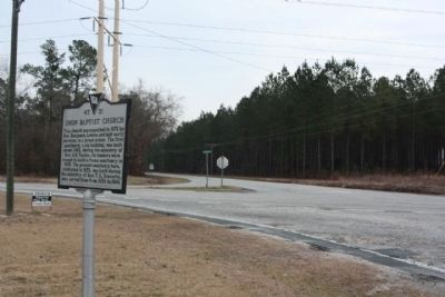
Church Marker seen at the intersection of Starks Ferry Road and Pinewood Road (State Road 120) image. Click for full size.
Photographed By Mike Stroud, February 4, 2010
2. Church Marker seen at the intersection of Starks Ferry Road and Pinewood Road (State Road 120)
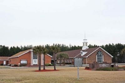
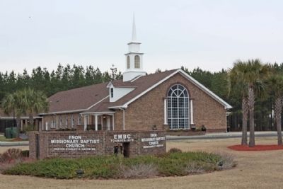
Enon Baptist Church and Marker image. Click for full size.
Photographed By Mike Stroud, February 4, 2010
3. Enon Baptist Church and Marker
Enon Baptist Church Marker image. Click for full size.
Photographed By Mike Stroud, February 4, 2010
4. Enon Baptist Church Marker
 
 
Credits. This page was last revised on June 16, 2016. It was originally submitted on February 14, 2010, by Mike Stroud of Bluffton, South Carolina. This page has been viewed 968 times since then and 26 times this year. Photos:   1, 2, 3, 4. submitted on February 14, 2010, by Mike Stroud of Bluffton, South Carolina. • Bill Pfingsten was the editor who published this page.
Share this page.  
Share on Tumblr
m=27486

CeraNet Cloud Computing sponsors the Historical Marker Database.
This website earns income from purchases you make after using our links to Amazon.com. We appreciate your support.
Paid Advertisement
Apr. 18, 2024