Weir in Williamson County, Texas — The American South (West South Central)
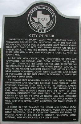
City of Weir
Tennessee-native Thomas Calvin Weir (1826-1901) came to Williamson County in 1856. He bought land in this area and became a prosperous farmer. Alabaman James Francis Towns (1850-1937) came in 1870 and settled nearby on the San Gabriel River. He and his brother, Robert W. Towns (1848-1938), operated a gin and blacksmith shop, as well as Towns' Mill.
In the late 19th century, the communities of Weir and Townsville (or Towns’ Mill) grew around these early settlers. Churches included Baptist and Presbyterian congregations that met at the Prairie Springs School, as well as an African American church that met in a school near Mankins Crossing. Calvin Weir’s daughter, Lucy, served as postmaster at the post office in Townsville, where she also ran a small store.
The communities developed similarly until 1893, when the Georgetown and Granger Railroad came through Weir, bypassing Townsville. In 1903, after the Missouri, Kansas and Texas Railroad (MKT) bought the line, known as the Katy, most area residents moved into the town of Weir, officially established that same year. The Katy Lake Resort, created by MKT on the river at Towns' Mill Dam, attracted tourists to the area. The Townsville post office moved to Weir, and with several new businesses, the town began to thrive.
A flood in 1913 damaged the resort and several local businesses, and after a severe drought, World War I and the Great Depression, Weir’s population faltered but began to prosper again in the mid-20th century. Following voter approval, Weir incorporated as a city in 1987.
Erected 2002 by Texas Historical Commission. (Marker Number 12640.)
Topics. This historical marker is listed in these topic lists: African Americans • Agriculture • Churches & Religion • Education • Industry & Commerce • Settlements & Settlers. A significant historical year for this entry is 1856.
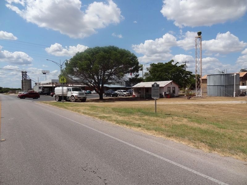
Location. 30° 40.487′ N, 97° 35.183′ W. Marker is in Weir, Texas, in Williamson County. Marker is on Farm to Market Road 971. Touch for map. Marker is in this post office area: Weir TX 78674, United States of America. Touch for directions.
Other nearby markers. At least 8 other markers are within 4 miles of this marker, measured as the crow flies. Weir Community Cemetery (approx. 0.9 miles away); Mankins Crossing (approx. 2 miles away); The Double File Trail (Georgetown) (approx. 2.1 miles away); Texan Santa Fe Expedition (approx. 2.1 miles away); Site of Neusser (Naizerville) (approx. 2˝ miles away); Pennington Family Cemetery (approx. 2.9 miles away); John Berry, Frontiersman (approx. 3.2 miles away); Community of Jonah (approx. 3.7 miles away).
Credits. This page was last revised on November 29, 2020. It was originally submitted on September 29, 2007, by Keith Peterson of Cedar Park, Texas. This page has been viewed 1,264 times since then and 39 times this year. Photos: 1. submitted on September 29, 2007, by Keith Peterson of Cedar Park, Texas. 2. submitted on August 31, 2019, by Keith Peterson of Cedar Park, Texas. • J. J. Prats was the editor who published this page.

