Avalon Beach in Monroe County, Michigan — The American Midwest (Great Lakes)
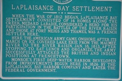
LaPlaisance Bay Settlement
Here the American Army came onshore after its march on ice covered Lake Erie from the Maumee River to the River Raisin. Jan. 18, 1813, after stopping to eat lunch and organize, the army successfully attacked the British and Indian positions at Frenchtown.
Monroe's first deep-water harbor developed from improvements begun here in 1826 by the LaPlaisance Bay Harbor Company and later the federal government.
Erected by Monroe County Historical Commission.
Topics. This historical marker is listed in these topic lists: Military • Native Americans • War of 1812. A significant historical date for this entry is January 18, 1891.
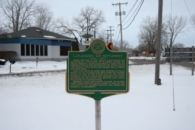
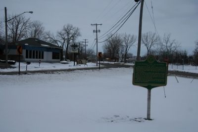
Location. 41° 52.318′ N, 83° 23.315′ W. Marker is in Avalon Beach, Michigan, in Monroe County. Marker is at the intersection of LaPlaisance Road and Lake Street, in the median on LaPlaisance Road. Touch for map. Marker is at or near this postal address: 13994 LaPlaisance Road, Monroe MI 48161, United States of America. Touch for directions.
Other nearby markers. At least 8 other markers are within 3 miles of this marker, measured as the crow flies. LaPlaisance Bay (approx. half a mile away); Airborne Memorial (approx. one mile away); Michigan: Historic Crossroads / Michigan: Twenty-Sixth State (approx. one mile away); Indian Attack (approx. 2.1 miles away); George Francis Heath, M.D. (approx. 2˝ miles away); Boston Custer - Autie Reed (approx. 2˝ miles away); Custer-Reed Plot (approx. 2˝ miles away); The Old Hull Road (approx. 2˝ miles away).
Credits. This page was last revised on January 23, 2021. It was originally submitted on February 17, 2010, by Dale K. Benington of Toledo, Ohio. This page has been viewed 1,669 times since then and 43 times this year. Last updated on January 21, 2021, by Craig Doda of Napoleon, Ohio. Photos: 1, 2, 3. submitted on February 17, 2010, by Dale K. Benington of Toledo, Ohio. • Mark Hilton was the editor who published this page.


