Oakalla in Burnet County, Texas — The American South (West South Central)
Oakalla
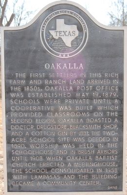
The first settlers in this rich farm and ranch land arrived in the 1850s. Oakalla Post Office was established May 19, 1879. Schools were private until a cooperative was built which provided classrooms on the second floor. Oakalla boasted a doctor, drugstore, blacksmith shop, and a cotton gin by 1881. The two-acre school site was deeded in 1890. Worship was held in the schoolhouse and in brush arbors until 1908 when Oakalla Baptist Church erected a meetinghouse. The school consolidated in 1958 with Lampasas and the building became a community center.
Erected 1979 by Texas Historical Commission. (Marker Number 9736.)
Topics. This historical marker is listed in this topic list: Settlements & Settlers. A significant historical date for this entry is May 19, 1878.
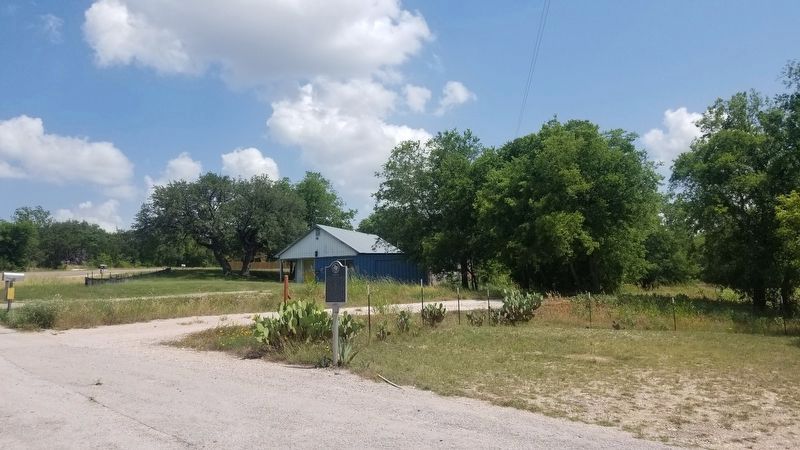
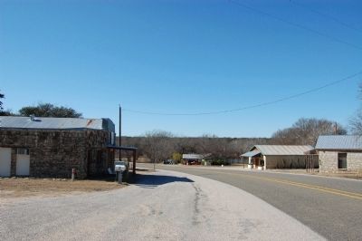
Location. 30° 59.181′ N, 97° 55.449′ W. Marker is in Oakalla, Texas, in Burnet County. Marker is on FM-963, 0.2 miles north of FM-2657 when traveling east. Touch for map. Marker is in this post office area: Killeen TX 76543, United States of America. Touch for directions.
Other nearby markers. At least 8 other markers are within 9 miles of this marker, measured as the crow flies. Tobey Cemetery (approx. 1.7 miles away); Gillum Cemetery (approx. 1.9 miles away); Smith Cemetery (approx. 3.4 miles away); Maxdale Cemetery (approx. 5.6 miles away); DeWolfe-Dillingham Community Cemetery (approx. 5.9 miles away); The Community of Briggs (approx. 6.7 miles away); Briggs State Bank (approx. 6.8 miles away); McBryde Cemetery (approx. 8.7 miles away). Touch for a list and map of all markers in Oakalla.
Also see . . . TexasEscapes.com. Oakalla, TX (Submitted on February 18, 2010, by Keith Peterson of Cedar Park, Texas.)
Credits. This page was last revised on November 25, 2020. It was originally submitted on February 18, 2010, by Keith Peterson of Cedar Park, Texas. This page has been viewed 1,236 times since then and 32 times this year. Photos: 1. submitted on February 18, 2010, by Keith Peterson of Cedar Park, Texas. 2. submitted on May 24, 2020, by Keith Peterson of Cedar Park, Texas. 3. submitted on February 18, 2010, by Keith Peterson of Cedar Park, Texas. • Bill Pfingsten was the editor who published this page.


