Near Cloonlaur in County Mayo, Connacht, Ireland — Irish West ((Éire) North Atlantic Ocean)
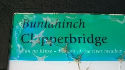
Bunlahinch Clapperbridge
Clew Bay Archaeological Trail site 14
— Slí Seandálaíochta Chuan Módh —
Bún na hInes - Bottom of the River Meadow
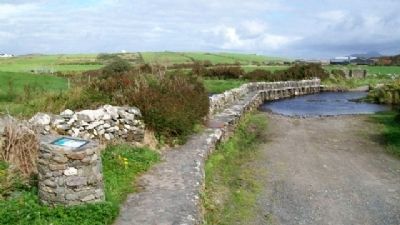
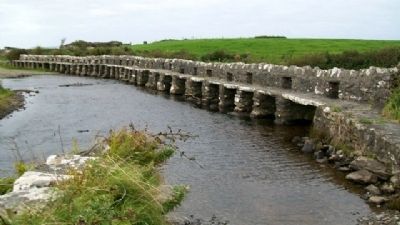
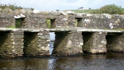
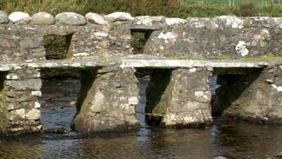
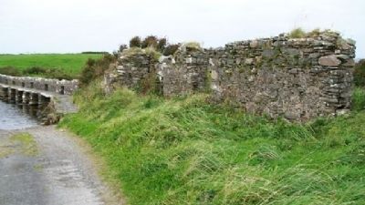
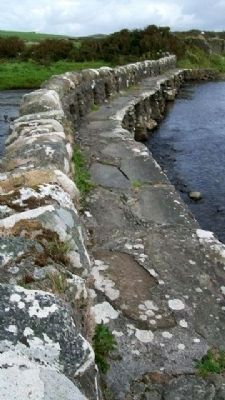
This clapperbridge is a very unusual feature in the West of Ireland. The word clapper originally meant plank in the Sussex area of England, where there are many examples. Clapperbridges are a pre-historic form of stone-built bridge. The basic structure consists of small stone piers or pillars, which are spanned by flat stone slabs or planks. They were designed to cross wide, flat streams and rivers, as seen here, and used as footbridges.
It is likely that this bridge was built in the 1840s or 50s as part of work carried out by the Irish Church Mission, a Protestant community or colony which was given the land rent free by the Marquis of Sligo. Locally, the area is still called The Colony.
Droichead Lindéir Bhun Leath Inse [Bun na hInse]
Is gné neamhghnách amach is amach é an droichead lindéir seo in Iarthar na hÉireann. Is sail an bhunbhrí a bhí leis an bhfocal lindéar i gceantar Sussex i Sasana, áit a bhfuil samplaí go leor de le fáil. Is cineál droichid cloiche réamhstairiúil é an droichead lindéir. Tá an struchtúr bunúsach déanta as piaraí nó piléir bheaga cloiche, a bhíonn trasnaithe ag leachtanna cothroma cloiche nó ag saileanna. Dearadh iad chun aibhneacha agus srutháin leathana, cothroma a thrasnú, mar a fheictear anseo, agus baineadh úsáid astu mar dhroichid coise.
Is é is dóichí gur tógadh an droichead seo sna 1840idí nó 1850idí mar chuid den obair a rinne Misean Eaglais na hÉireann, pobal nó coilíneacht Phrotastúnach ar thug Marcas Shligigh talamh saor ó chíos dóibh. Tugtar an Choilíneacht go háitiúil ar an gceantar go fóill.
[Marker is damaged]
Erected by Mayo County Council, South West Mayo, and Comhoail Oileáin na hÉireann.
Topics. This historical marker is listed in these topic lists: Bridges & Viaducts • Man-Made Features • Settlements & Settlers.
Location. 53° 43.09′ N, 9° 53.352′ W. Marker is near Cloonlaur, Connacht, in County Mayo. Marker is at the west end of the bridge, on the road between Cross and Roonith Hill. Touch for map. Touch for directions.
Other nearby markers. At least 5 other markers are within 10 kilometers of this marker, measured as the crow flies. Killeen Graveyard and Cross Slab (approx. 0.7 kilometers away); Srahwee or Altóir Megalithic Wedge Tomb (approx. 4.4 kilometers away); Famine Museum and Granuaile Centre, Louisburgh (approx. 7.3 kilometers away); Lime Kiln, Moneen, (approx. 8.8 kilometers away); 1849 Famine Walk (approx. 9.2 kilometers away).
Also see . . .
1. Clew Bay Archaeological Trail. (Submitted on February 28, 2010.)
2. Clapper Bridge. (Submitted on February 28, 2010.)
Additional keywords. Bunlahinch Clapperbridge
Credits. This page was last revised on June 16, 2016. It was originally submitted on February 28, 2010, by William Fischer, Jr. of Scranton, Pennsylvania. This page has been viewed 1,713 times since then and 10 times this year. Photos: 1, 2, 3, 4, 5, 6, 7. submitted on February 28, 2010, by William Fischer, Jr. of Scranton, Pennsylvania.
Editor’s want-list for this marker. Close photo of full marker. • Can you help?
