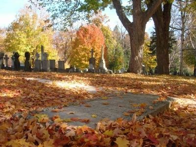
Old Bennington in Bennington County, Vermont — The American Northeast (New England)
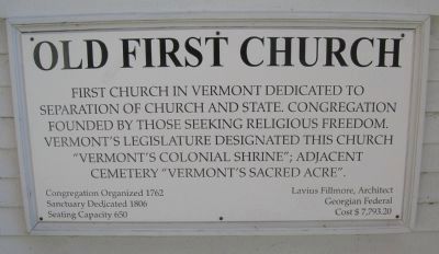
Vermont's Colonial Shrine
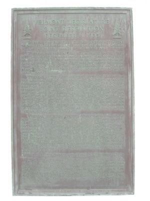
Vermont Legislature Joint Resolution December 11, 1935
Whereas, our forefathers met in Prayer in the First Meeting House for assistance against the oppressive measures of New York and the overwhelming power of King George, and to the First Meeting House returned from the capture of Fort Ticonderoga, the Battle of Bennington, the surrender of Burgoyne to offer up their Thanksgiving; and
Whereas, in the first Meeting House of Bennington the Legislature of Vermont met on eight separate occasions, and the laws for carrying on the Government of this sovereign state were enacted at the Meeting House on February 11, 1779; and the convention, consisting of one Delegate from each Town, Held in Bennington on January 10, 1791, ratified the Constitution of the United States by the signatures of 105 out of 109 Delegates, thereby preparing the way for the admission of Vermont into the Union as the first state after the Original Thirteen; and
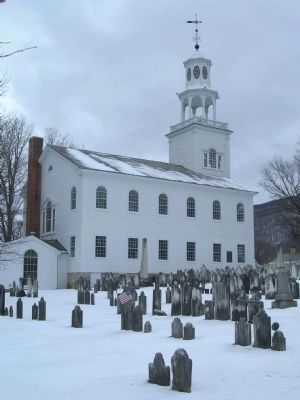
Whereas, the burial ground, surrounding the aforementioned church structure is the first and oldest cemetery in the state, where lie the remains of five Governors of Vermont, seventy-five Revolutionary Soldiers, the author of Vermont's Declaration of Independence, the founder of the Vermont Gazette, the Patriots who fell at the Battle of Bennington, The Hessian prisoners who died of their wounds in the First Meeting House converted into a temporary hospital, together with scores of others who labored for the stability and prosperity of Vermont; now, therefore, be it
Resolved by the Senate and House of Representatives:
That the aforesaid Bennington Center Cemetery and the aforementioned First Church Building are hereby Declared to be Vermont's Colonial Shrine for the preservation of the sacred memories and traditions of Colonial Days, in order that our children's children may cherish the great deeds of our fathers and build on the foundations laid by them the commonwealth of the future.
Erected 1937 by The Vermont State Legislature.
Topics. This historical marker is listed in these topic lists: Cemeteries & Burial Sites • Churches & Religion • Colonial Era • Patriots & Patriotism • War, US Revolutionary. A significant historical month for this entry is January 1805.
Location. 42° 53.01′ N, 73° 12.772′ W. Marker is in Bennington, Vermont, in Bennington County. It is in Old Bennington. Marker can be reached from Monument Ave., on the left when traveling south. Touch for map. Marker is in this post office area: Bennington VT 05201, United States of America. Touch for directions.
Other nearby markers.
At least 8 other markers are within walking distance of this marker. William Lloyd Garrison (within shouting distance of this marker); Ethan Allen (about 300 feet away, measured in a direct line); Bennington Battle Monument (about 400 feet away); Site of the Catamount Tavern - 1767 (about 500 feet away); Bennington Civil War Monument (approx. 0.2 miles away); Vermont (approx. 0.2 miles away); Captain Samuel Robinson (approx. 0.2 miles away); The "Corkscrew" Railroad (approx. 0.2 miles away). Touch for a list and map of all markers in Bennington.
More about this marker. The church building is across the green from, and easily seen from Vermont Rt. 9 (West Main Street). The Marker is mounted on the north side of the church, which faces the adjacent cemetery which is know as "Vermont's Sacred Acre."
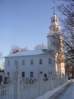
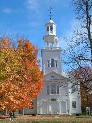
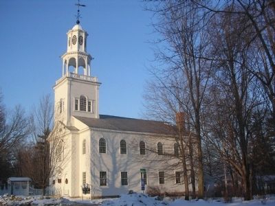
Regarding Vermont's Colonial Shrine. Build Dates: from June 25, 1804 to January 1, 1806. Architect: Lavius Fillmore. Church founded 1762; affiliated with Congregational Church 1832; first meeting-house erected 1766; moved to new site in 1806. Reverend Jedidiah Dewey, first pastor. Ethan Allen, Revolutionary patriot, attended church here. Reverend Vincent Ravi-Booth, pastor of church 19-19-1944, was founder of Bennington College, and also was responsible for restoration of the church in 1936-37.
The
First Congregational Church of Bennington, Vermont is currently associated with the National Association of Congregational Christian Churches. This building has been documented in the Historic American Buildings Survey/Historic American Engineering Record as the First Congregational Church, Monument Avenue, on Bennington Green at State Route 9 in "Old Bennington", Bennington, Bennington County, VT also know as The Old First Church.
Photographed By Howard C. Ohlhous, February 4, 2009
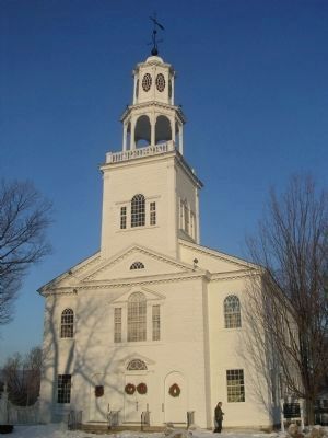
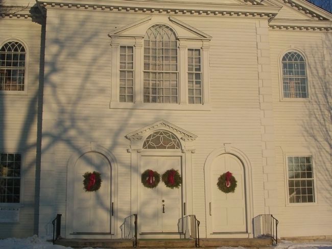
8. Vermont's Colonial Shrine - Front Detail
Frame with clapboard and corner quioins, three-bay front x five bays, two stories with three-stage tower over projecting center bay. Fine example of early-19th C. New England church. Built 1804-05; altered 1849, 1851, 1964, restored 1936-37. Lavius Fillmore, designer; Dennison Hall, restoration architect.
Photographed By Habs/haer, 1940
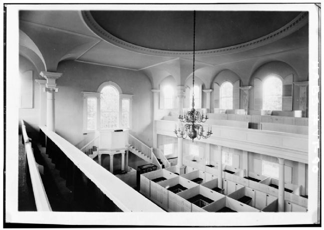
9. Vermont's Colonial Shrine
This building has been documented in the Historic American Buildings Survey/Historic American Engineering Record as the First Congregational Church, Monument Avenue, on Bennington Green at State Route 9 in "Old Bennington", Bennington, Bennington County, VT also know as The Old First Church.
Photographed By Howard C. Ohlhous, October 24, 2008
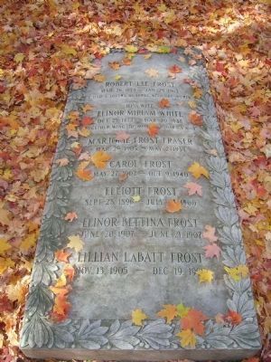
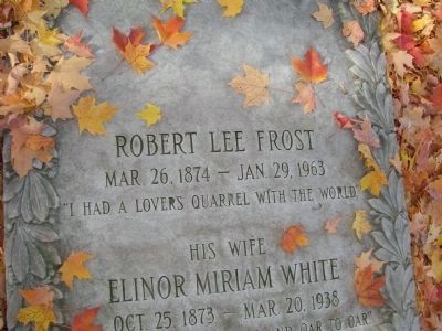
10. Robert Frost, 1958 Poet Laureate Consultant in Poetry to the Library of Congress
Robert Frost's remains are buried in the cemetery adjacent to the church. Although he was not a member of the church, he read his poem, The Black Cottage, at the rededication of the church building in 1937, after its restoration to the original interior design. At that time, the state legislature designated the church as "Vermont's Colonial Shrine" and the cemetery, "Vermont's Sacred Acre." Frost bought two lots in 1940 for a family burial place.
Credits. This page was last revised on February 16, 2023. It was originally submitted on March 6, 2010, by Howard C. Ohlhous of Duanesburg, New York. This page has been viewed 1,433 times since then and 30 times this year. Photos: 1, 2, 3, 4, 5, 6, 7, 8, 9, 10, 11, 12. submitted on March 6, 2010, by Howard C. Ohlhous of Duanesburg, New York. • Bill Pfingsten was the editor who published this page.
