Marker Logo HMdb.org THE HISTORICAL
MARKER DATABASE
“Bite-Size Bits of Local, National, and Global History”
Hoover in Jefferson County, Alabama — The American South (East South Central)
 

Founding Of Hoover


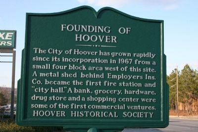
Founding Of Hoover Marker image. Click for full size.
Photographed By Tim Carr, February 24, 2010
1. Founding Of Hoover Marker
Inscription. The City of Hoover has grown rapidly since its incorporation in 1967 from a small four block area west of this site. A metal shed behind Employers Ins. Co. became the first fire station and “city hall.” A bank, grocery, hardware, drug store and a shopping center were some of the first commercial ventures.
 
Erected by Hoover Historical Society.
 
Topics. This historical marker is listed in these topic lists: Industry & CommerceScience & MedicineSettlements & Settlers. A significant historical year for this entry is 1967.
 
Location. 33° 24.172′ N, 86° 48.38′ W. Marker is in Hoover, Alabama, in Jefferson County. Marker is at the intersection of Montgomery Highway (U.S. 31) and Braddock Drive, on the right when traveling south on Montgomery Highway. Touch for map. Marker is in this post office area: Birmingham AL 35226, United States of America. Touch for directions.
 
Other nearby markers. At least 8 other markers are within 3 miles of this marker, measured as the crow flies. Monte D'Oro (approx. 0.3 miles away); Patton Chapel Church 1866 (approx. 0.8 miles away); Hoover (approx. one mile away); Rocky Ridge Elementary School (approx. 2.4 miles away); Shades Crest Road Historical District (approx. 2˝ miles away); Hale - Joseph Home (approx. 2.7
Paid Advertisement
Click on the ad for more information.
Please report objectionable advertising to the Editor.
Click or scan to see
this page online
miles away); Bluff Park Elementary School / Hoover Community Education (approx. 2.8 miles away); Briarwood Presbyterian Church PCA (approx. 2.9 miles away). Touch for a list and map of all markers in Hoover.
 
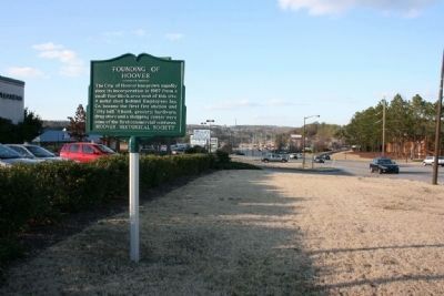
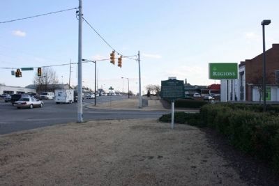
Founding Of Hoover Marker, Southbound view along Montgomery Highway image. Click for full size.
Photographed By Tim Carr, February 24, 2010
2. Founding Of Hoover Marker, Southbound view along Montgomery Highway
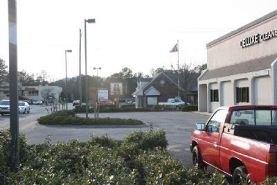
Founding Of Hoover Marker Northbound view along Montgomery Highway image. Click for full size.
Photographed By Tim Carr, February 24, 2010
3. Founding Of Hoover Marker Northbound view along Montgomery Highway
West view of the marker where Hoover began its growth image. Click for full size.
Photographed By Tim Carr, February 24, 2010
4. West view of the marker where Hoover began its growth
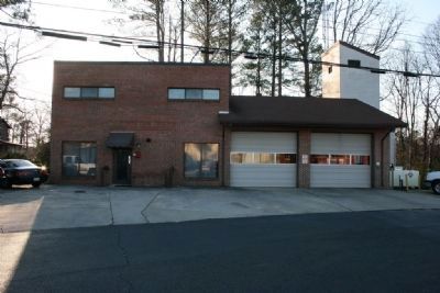
The current Hoover Fire Station near the original site. image. Click for full size.
Photographed By Tim Carr, February 24, 2010
5. The current Hoover Fire Station near the original site.
 
 
Credits. This page was last revised on November 2, 2019. It was originally submitted on March 9, 2010, by Timothy Carr of Birmingham, Alabama. This page has been viewed 1,370 times since then and 28 times this year. Photos:   1, 2, 3, 4, 5. submitted on March 9, 2010, by Timothy Carr of Birmingham, Alabama. • Bill Pfingsten was the editor who published this page.
Share this page.  
Share on Tumblr
m=28448

CeraNet Cloud Computing sponsors the Historical Marker Database.
This website earns income from purchases you make after using our links to Amazon.com. We appreciate your support.
Paid Advertisement
Apr. 19, 2024