Defiance in Defiance County, Ohio — The American Midwest (Great Lakes)
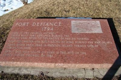
Fort Defiance, 1794
Fort Winchester was built south of here during the War of 1812.
Down river from here is Preston Island, former site of Indian villages.
About one mile south of here is the site of the large Indian Council of 1792.
Topics. This historical marker is listed in these topic lists: Forts and Castles • Military • Native Americans • War of 1812 • Wars, US Indian. A significant historical year for this entry is 1794.
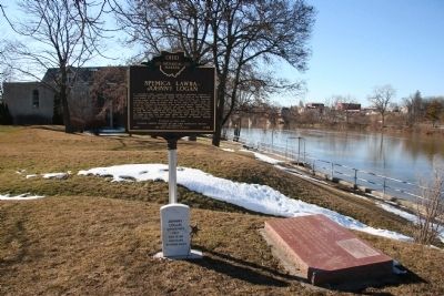
Location. 41° 17.262′ N, 84° 21.421′ W. Marker is in Defiance, Ohio, in Defiance County. Marker can be reached from Fort Street near Washington Street. This historical marker is located in the park that marks the site of General Wayne's Fort Defiance. The marker is inscribed on a red stone slab that is situated on the high ground overlooking the Maumee River next to the state historical marker for Spemica Lawba-Johnny Logan. Touch for map. Marker is in this post office area: Defiance OH 43512, United States of America. Touch for directions.
Other nearby markers. At least 8 other markers are within walking distance of this marker. Spemica Lawba–Johnny Logan (a few steps from this marker); Civil War Cannons (a few steps from this marker); Buffalo Were Recorded Here In 1718 (a few steps from this marker); Cross Section of the Trench (a few steps from this marker); North Blockhouse (a few steps from this marker); West Blockhouse (within shouting distance of this marker); Construction Of Fort Defiance (within shouting distance of this marker); Legion of Anthony Wayne (within shouting distance of this marker). Touch for a list and map of all markers in Defiance.

Photographed By Dale K. Benington, March 6, 2010
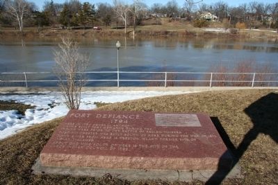
3. Fort Defiance, 1794 Marker
View looking west with the historical marker in the right foreground next to the state historical marker for
Spemica Lawba-Johnny Logan and a view looking upstream of the Maumee River in the right-center background of the picture.
Credits. This page was last revised on June 16, 2016. It was originally submitted on March 12, 2010, by Dale K. Benington of Toledo, Ohio. This page has been viewed 1,320 times since then and 11 times this year. Photos: 1, 2, 3. submitted on March 12, 2010, by Dale K. Benington of Toledo, Ohio.

