Near Kure Beach in New Hanover County, North Carolina — The American South (South Atlantic)
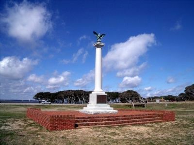
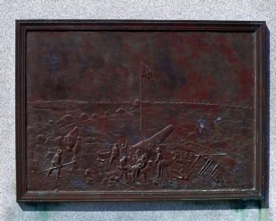
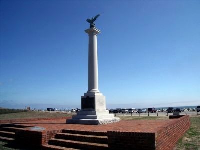
Fort Fisher Monument
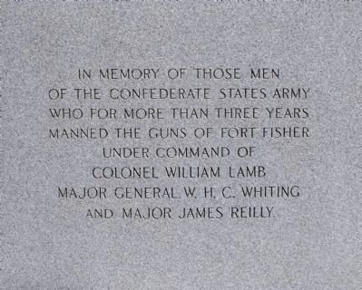
(south face)
In memory of those men of the Confederate States Army who for more than three years manned the guns of Fort Fisher under command of Colonel William Lamb, Major General W.H.C. Whiting and Major James Reilly.
(north face)
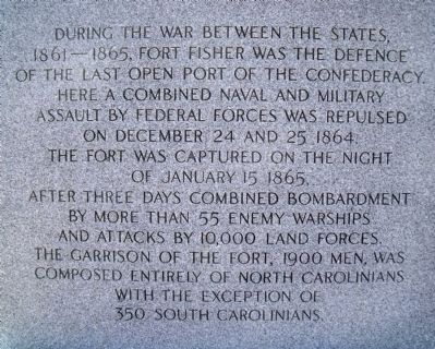
During the War Between the States, 1861-1865, Fort Fisher was the defence of the last open port of the Confederacy. Here a combined naval and military assault by Federal forces was repulsed on December 24 and 25, 1864. The fort was captured on the night of January 15, 1865, after three days combined bombardment by more than 55 enemy warships and attacks by 10,000 land forces. The garrison of the fort, 1900 men, was composed entirely of North Carolinians with the exception of 350 South Carolinians.
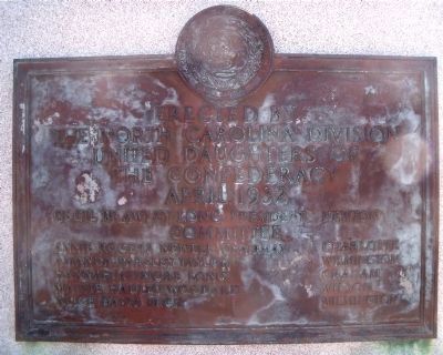
(west face)
Erected by The North Carolina Division United Daughters of the Confederacy
April, 1932
Cecil Brawley Long, President Newton
Committee
Annie Rogers Newell, Chairman Charlotte
Amanda Parsley Taylor Wilmington
Hannah Attmore Long Graham
Mattie Hadley Woodard Wilson
Alice Davis Peck Wilmington
Erected 1932 by United Daughters of the Confederacy.
Topics and series. This historical marker and monument is listed in these topic lists: Forts and Castles • War, US Civil. In addition, it is included in the United Daughters of the Confederacy series list. A significant historical month for this entry is January 1803.
Location. 33° 58.162′ N, 77° 55.094′ W. Marker is near Kure Beach, North Carolina, in New Hanover County. Marker is on Battle Acre Road near Fort Fisher Boulevard South (U.S. 421), on the right when traveling south. Touch for map. Marker is in this post office area: Kure Beach NC 28449, United States of America. Touch for directions.
Other nearby markers. At least 8 other markers are within walking distance of this marker. Headquarters of Fort Fisher (within shouting distance of this marker); Fort Fisher (within shouting distance of this marker); W.H.C. Whiting (within shouting distance of this marker); a different marker also named Fort Fisher (about 400 feet away, measured in a direct line); Fort Fisher Since 1865 (about 600 feet away); Fighting the Sea - Saving the Fort (about 600 feet away); Blockade-Running (about 600 feet away); Capture! (about 700 feet away). Touch for a list and map of all markers in Kure Beach.
Also see . . .
1. Fort Fisher Memorial. Commemorative Landscapes website entry (Submitted on March 15, 2010.)
2. Fort Fisher. North Carolina Historic Sites entry (Submitted on March 15, 2010.)
Credits. This page was last revised on March 25, 2022. It was originally submitted on March 15, 2010, by Bernard Fisher of Richmond, Virginia. This page has been viewed 1,773 times since then and 23 times this year. Photos: 1, 2, 3, 4, 5, 6, 7. submitted on March 15, 2010, by Bernard Fisher of Richmond, Virginia.
