Blenheim Square - Research Hospital in Kansas City in Jackson County, Missouri — The American Midwest (Upper Plains)
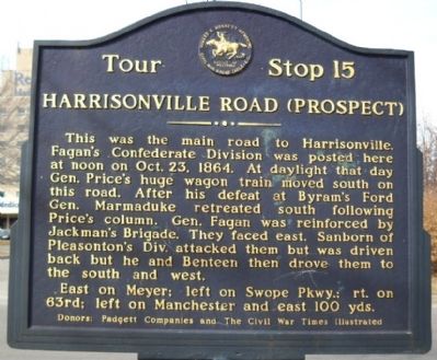
Harrisonville Road (Prospect)
Inscription.
This was the main road to Harrisonville. Faganís Confederate Division was posted here at noon on Oct.23, 1864. At daylight that day Gen. Priceís huge wagon train moved south on this road. After his defeat at Byramís Ford Gen. Marmaduke retreated south following Priceís column. Gen. Fagan was reinforced by Jackmanís Brigade. They faced east. Sanborn of Pleasontonís Div. attacked them but was driven back but he and Benteen then drove them to the south and west.
Erected by Padgett Companies and The Civil War Times Illustrated. (Marker Number 15.)
Topics and series. This historical marker is listed in this topic list: War, US Civil. In addition, it is included in the Missouri Ė Battle of Westport series list. A significant historical year for this entry is 1864.
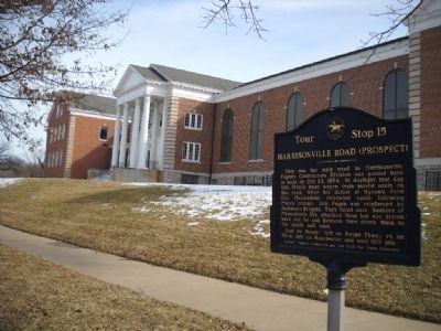
Location. 39° 0.409′ N, 94° 33.452′ W. Marker is in Kansas City, Missouri, in Jackson County. It is in Blenheim Square - Research Hospital. Marker is at the intersection of Meyer Blvd and Wabash Avenue, on the right when traveling east on Meyer Blvd. Touch for map. Marker is at or near this postal address: 2525 E Meyer Blvd, Kansas City MO 64132, United States of America. Touch for directions.
Other nearby markers. At least 8 other markers are within walking distance of this marker. Replica of the Statue of Liberty (about 400 feet away, measured in a direct line); Delbert J. Haff (approx. 0.7 miles away); Forest Hill Confederate Memorial (approx. 0.8 miles away); Waldo P. Johnson (approx. 0.8 miles away); Leroy Robert "Satchel" Paige (approx. 0.8 miles away); Battle of the Big Blue (approx. 0.9 miles away); "Boston" Adams' House (approx. 0.9 miles away); Kansas City's First Public Golf Course (approx. 0.9 miles away). Touch for a list and map of all markers in Kansas City.
More about this marker. Park either on Wabash or in the back of the College.
Also see . . . Battle of Westport. Link from the Civil War Muse with further information on this tour stop. (Submitted on March 16, 2010, by Thomas Onions of Olathe, Kansas.)
Credits. This page was last revised on February 10, 2023. It was originally submitted on March 16, 2010, by Thomas Onions of Olathe, Kansas. This page has been viewed 1,344 times since then and 14 times this year. Photos: 1, 2. submitted on March 16, 2010, by Thomas Onions of Olathe, Kansas.

