Falls Church, Virginia — The American South (Mid-Atlantic)
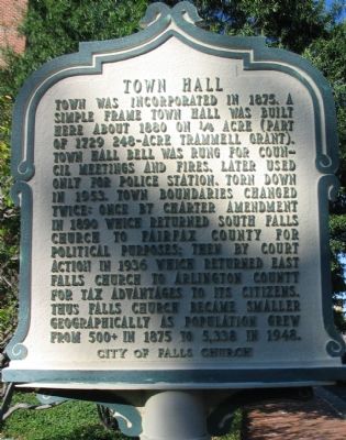
Town Hall
Erected by City of Falls Church.
Topics and series. This historical marker is listed in this topic list: Political Subdivisions. In addition, it is included in the Virginia, City of Falls Church series list. A significant historical year for this entry is 1875.
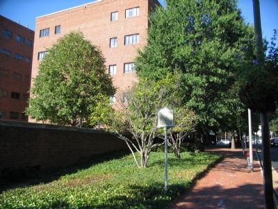
Location. 38° 52.904′ N, 77° 10.308′ W. Marker is in Falls Church, Virginia. Marker is at the intersection of Washington Street (U.S. 29) and Broad Street (State Highway 7), on the right when traveling south on Washington Street. Touch for map. Marker is in this post office area: Falls Church VA 22046, United States of America. Touch for directions.
Other nearby markers. At least 8 other markers are within walking distance of this marker. Star Tavern (within shouting distance of this marker); New York Memorial Stone at Falls Church (within shouting distance of this marker); Union Soldiers (about 300 feet away, measured in a direct line); The Falls Church (about 300 feet away); To the Glory of God and in Honor of George Washington (about 300 feet away); Enslaved People (about 300 feet away); James Wren (about 300 feet away); Confederate Soldiers (about 300 feet away). Touch for a list and map of all markers in Falls Church.
Also see . . . East Falls Church. (PDF) Short history of the community, with discussion of the break from Falls Church and addition to Arlington County. The section twice shifted jurisdiction. Rejoining Virginia when leaving the District of Columbia in 1846, then later as mentioned on the marker in 1936 from Falls Church to Arlington County. (Submitted on October 9, 2007, by Craig Swain of Leesburg, Virginia.)
Credits. This page was last revised on June 27, 2022. It was originally submitted on October 9, 2007, by Craig Swain of Leesburg, Virginia. This page has been viewed 1,825 times since then and 22 times this year. Photos: 1, 2. submitted on October 9, 2007, by Craig Swain of Leesburg, Virginia.

