Near Elgin in Lauderdale County, Alabama — The American South (East South Central)
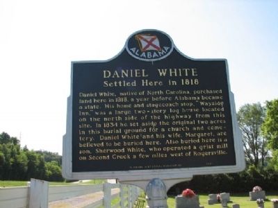
Daniel White
Settled Here in 1818
Erected by Alabama Historical Association.
Topics and series. This historical marker is listed in these topic lists: Cemeteries & Burial Sites • Churches & Religion • Notable Buildings • Notable Places • Settlements & Settlers. In addition, it is included in the Alabama Historical Association series list. A significant historical year for this entry is 1818.
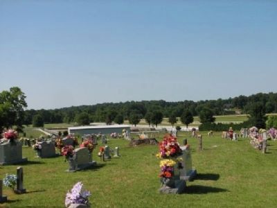
Location. 34° 51.286′ N, 87° 24.654′ W. Marker is near Elgin, Alabama, in Lauderdale County. Marker is on Lee Highway (U.S. 72) 0.7 miles west of County Road 583, on the left when traveling west. Marker is located in front of the Barkley Cemetery. Touch for map. Marker is at or near this postal address: 6048 US 72, Rogersville AL 35652, United States of America. Touch for directions.
Other nearby markers. At least 8 other markers are within 3 miles of this marker, measured as the crow flies. Cherokee Chief Doublehead's Village Around 1800 (about 300 feet away, measured in a direct line); Gabriel “Old Gabe” Butler (approx. 1.2 miles away); Elgin/Elgin Crossroads (approx. 1.2 miles away); Jesse James Gang Canal Payroll Robbery/Trial of Frank James (approx. 1.4 miles away); Mitchell Town Community (approx. 1.7 miles away); Covington/Second Creek / Wheeler Dam/Lake (approx. 2.3 miles away); Center (Centre) Star (approx. 2˝ miles away); Springfield Community 1810/Springfield Church and School (approx. 2.7 miles away). Touch for a list and map of all markers in Elgin.
Also see . . .
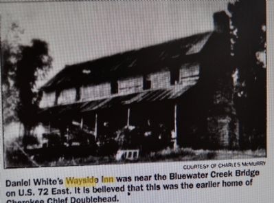
1. Doublehead makes home at Shoals. Daniel White Wayside Inn was near the Blue Water Creek Bridge on U.S. 72 E. Is believed to be the earlier home of Doublehead. (Submitted on March 22, 2010, by Sandra Hughes Tidwell of Killen, Alabama, USA.)
2. Daniel White at "Find A Grave". (Submitted on July 4, 2020, by Sandra Hughes Tidwell of Killen, Alabama, USA.)
Credits. This page was last revised on July 6, 2020. It was originally submitted on March 22, 2010, by Sandra Hughes Tidwell of Killen, Alabama, USA. This page has been viewed 3,388 times since then and 73 times this year. Last updated on March 27, 2010, by Sandra Hughes Tidwell of Killen, Alabama, USA. Photos: 1, 2, 3. submitted on March 22, 2010, by Sandra Hughes Tidwell of Killen, Alabama, USA. • Bill Pfingsten was the editor who published this page.


