Hamiltonban Township near Orrtanna in Adams County, Pennsylvania — The American Northeast (Mid-Atlantic)
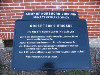
Robertson's Brigade
Stuart's Cavalry Division
— Army of Northern Virginia —
Stuart's Cavalry Division
Robertson's Brigade
4th. and 5th North Carolina Cavalry
July 1 The Brigade crossed the Potomac at Williamsport Md. and marched to Greencastle Pa.
July 2 Marched from Greencastle Pa. to Chambersburg Pa.
July 3 Marched to Cashtown and in the direction of Fairfield guarding the flank of the Army.
July 4 Held Jack's Mountain and picketed the left flank of the Army.
No report nor details of losses.
Erected by Gettysburg National Military Park Commission.
Topics. This historical marker is listed in this topic list: War, US Civil. A significant historical month for this entry is July 1830.
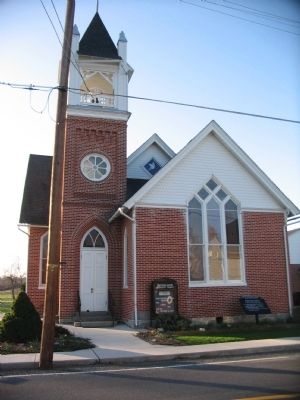
Location. 39° 50.711′ N, 77° 21.661′ W. Marker is near Orrtanna, Pennsylvania, in Adams County. It is in Hamiltonban Township. Marker is at the intersection of Carrolls Tract Road (County Route 3011) and Church Road, on the right when traveling north on Carrolls Tract Road. Located in front of the Orrtanna United Methodist Church. Touch for map. Marker is at or near this postal address: 1720 Carrolls Tract Rd, Orrtanna PA 17353, United States of America. Touch for directions.
Other nearby markers. At least 8 other markers are within 3 miles of this marker, measured as the crow flies. Hugh Culbertson Farm (approx. 0.9 miles away); Sixth Regiment U.S. Cavalry (approx. 1.2 miles away); Jones's Brigade (approx. 1.4 miles away); Site of School House and Burial Ground (approx. 2.4 miles away); The Battle of Gettysburg: The Cashtown Road (approx. 2.4 miles away); McKnightstown (approx. 2˝ miles away); Highway Enterprise (approx. 2˝ miles away); Cashtown (approx. 2.6 miles away). Touch for a list and map of all markers in Orrtanna.
Related markers. Click here for a list of markers that are related to this marker. Roberston's Cavalry Brigade during the Gettysburg Campaign.
Credits. This page was last revised on February 7, 2023. It was originally submitted on March 28, 2010, by Craig Swain of Leesburg, Virginia. This page has been viewed 1,385 times since then and 17 times this year. Photos: 1, 2. submitted on March 28, 2010, by Craig Swain of Leesburg, Virginia.

