Near Richmond in Henrico County, Virginia — The American South (Mid-Atlantic)
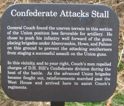
Confederate Attacks Stall
In this vicinity, and to your right, Couch's men repelled charges of D.H. Hill's Confederate division during the heat of the battle. As the advanced Union brigades became fought out, reinforcements marched past the West House and arrived here to assist Couch's regiments.
Topics. This historical marker is listed in this topic list: War, US Civil.
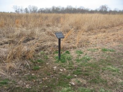
Location. 37° 24.956′ N, 77° 14.772′ W. Marker is near Richmond, Virginia, in Henrico County. Marker can be reached from Willis Church Road (State Highway 153), on the right when traveling north. Marker is in the Malvern Hill Battlefield Unit of Richmond National Battlefield Park, near the West House. Touch for map. Marker is at or near this postal address: 9051 Willis Church Rd, Henrico VA 23231, United States of America. Touch for directions.
Other nearby markers. At least 8 other markers are within walking distance of this marker. The Battle of Malvern Hill (about 300 feet away, measured in a direct line); Infantry Against Infantry (about 500 feet away); a different marker also named The Battle of Malvern Hill (about 600 feet away); Twilight Action (about 800 feet away); Malvern Hill Trail (approx. 0.2 miles away); Union Reserves (approx. 0.2 miles away); Seven Days Battles (approx. 0.2 miles away); Methodist Parsonage (approx. 0.2 miles away).
Also see . . .
1. Touring Richmond’s Battlefields. National Park Service website. (Submitted on March 28, 2010, by Craig Swain of Leesburg, Virginia.)
2. Malvern Hill Battlefield Podcast. National Park Service website. (Submitted on March 28, 2010, by Craig Swain of Leesburg, Virginia.)

2. Malvern Hill - CWPT
Civil War Preservation Trust's efforts to preserve portions of the battlefield.
Click for more information.
Click for more information.

Photographed By Craig Swain, March 21, 2010
4. D.H. Hill's Attack
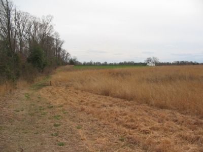
Looking back south on the trail at the marker location (on the left), toward the West House (right-center distance). Garland's Confederate Brigade of D.H. Hill's Division advanced toward the Federal lines along what is today the path of the trail. Facing them were portions of Palmer's Brigade, specifically the 10th Massachusetts Infantry.
Credits. This page was last revised on July 7, 2021. It was originally submitted on March 28, 2010, by Craig Swain of Leesburg, Virginia. This page has been viewed 924 times since then and 16 times this year. Photos: 1, 2, 3, 4. submitted on March 28, 2010, by Craig Swain of Leesburg, Virginia.

