Marker Logo HMdb.org THE HISTORICAL
MARKER DATABASE
“Bite-Size Bits of Local, National, and Global History”
Eastover in Richland County, South Carolina — The American South (South Atlantic)
 

St. Phillip A.M.E. Church


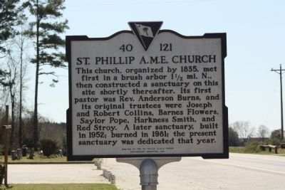
St. Phillip A.M.E. Church Marker image. Click for full size.
Photographed By Mike Stroud, 2010
1. St. Phillip A.M.E. Church Marker
Inscription. This church, organized by 1835, met first in a brush arbor 1 ½ mi. N., then constructed a sanctuary on this site shortly thereafter. Its first pastor was Rev. Anderson Burns, and its original trustees were Joseph and Robert Collins, Barnes Flowers, Saylor Pope, Harkness Smith, and Red Stroy. A later sanctuary, built in 1952; burned in 1981; the present sanctuary was dedicated that year.
 
Erected 1999 by the St. Phillip A.M.E. Church Anniversary Committeee. (Marker Number 40-121.)
 
Topics and series. This historical marker is listed in this topic list: Churches & Religion. In addition, it is included in the African Methodist Episcopal (AME) Church series list. A significant historical year for this entry is 1835.
 
Location. 33° 50.973′ N, 80° 39.012′ W. Marker is in Eastover, South Carolina, in Richland County. Marker is on McCords Ferry Road (U.S. 601), on the right when traveling north. Located just south of Gatehill Road. Touch for map. Marker is in this post office area: Eastover SC 29044, United States of America. Touch for directions.
 
Other nearby markers. At least 8 other markers are within 7 miles of this marker, measured as the crow flies. Kensington (approx. 1.4 miles away); Richland Presbyterian Church (approx. 2.9 miles away); Eastover (approx. 3.2 miles away); Kingville (approx. 4.2 miles away); Congaree River Ferries
Paid Advertisement
Click on the ad for more information.
Please report objectionable advertising to the Editor.
Click or scan to see
this page online
(approx. 6 miles away); Site of Rebecca Motte's Home (approx. 6.3 miles away); John M. Bates Bridge (approx. 6.4 miles away); Gadsden (approx. 6.8 miles away). Touch for a list and map of all markers in Eastover.
 
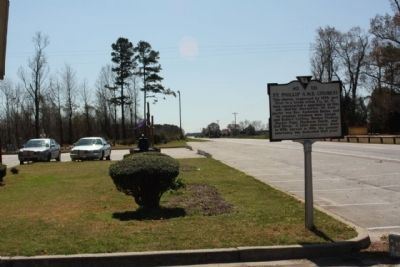
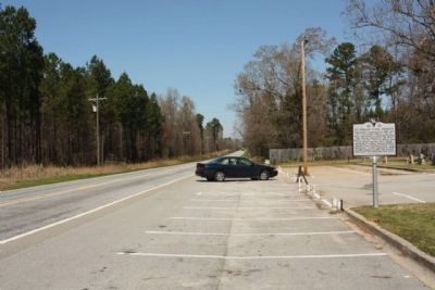
St. Phillip A.M.E. Church Marker, looking north along US 601 image. Click for full size.
Photographed By Mike Stroud, March 23, 2010
2. St. Phillip A.M.E. Church Marker, looking north along US 601
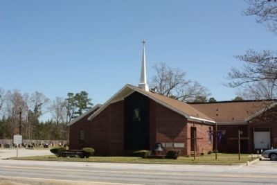
St. Phillip A.M.E. Church and Marker image. Click for full size.
Photographed By Mike Stroud, March 23, 2010
3. St. Phillip A.M.E. Church and Marker
St. Phillip A.M.E. Church Marker, lookig southward along US 601 image. Click for full size.
Photographed By Mike Stroud, March 23, 2010
4. St. Phillip A.M.E. Church Marker, lookig southward along US 601
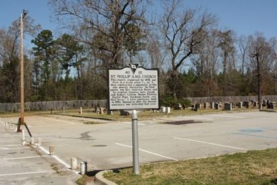
St. Phillip A.M.E. Church Marker and Cemetery image. Click for full size.
Photographed By Mike Stroud, March 23, 2010
5. St. Phillip A.M.E. Church Marker and Cemetery
 
 
Credits. This page was last revised on June 16, 2016. It was originally submitted on March 30, 2010, by Mike Stroud of Bluffton, South Carolina. This page has been viewed 1,006 times since then and 39 times this year. Photos:   1, 2, 3, 4, 5. submitted on March 30, 2010, by Mike Stroud of Bluffton, South Carolina. • Kevin W. was the editor who published this page.
Share this page.  
Share on Tumblr
m=29316

CeraNet Cloud Computing sponsors the Historical Marker Database.
This website earns income from purchases you make after using our links to Amazon.com. We appreciate your support.
Paid Advertisements
Mar. 19, 2024