Sumter in Sumter County, South Carolina — The American South (South Atlantic)
Henry J. Maxwell Farm
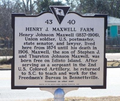
Henry Johnson Maxwell (1837-1906), Union soldier, U.S. postmaster, state senator, and lawyer, lived here from 1874 until his death in 1906. Maxwell, the son of Stephen J. and Thurston Johnson Maxwell, was born free on Edisto Island. After serving as a sergeant in the 2nd U.S. Colored Artillery, he returned to S.C. to teach and work for the Freedmen’s Bureau in Bennettsville.
(Reverse text)
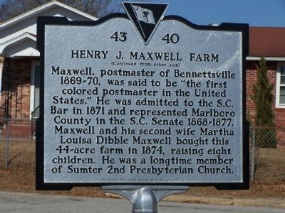
Maxwell, postmaster of Bennettsville 1869-70, was said to be “the first colored postmaster in the United States.” He was admitted to the S.C. Bar in 1871 and represented Marlboro County in the S.C. Senate 1868-1877. Maxwell and his second wife Martha Louisa Dibble Maxwell bought this 44-acre farm in 1874, raising eight children. He was a longtime member of Sumter 2nd Presbyterian Church.
Erected 2008 by The Naudin-Dibble Heritage Foundation. (Marker Number 43-40.)
Topics. This historical marker is listed in these topic lists: African Americans • Agriculture • Communications • War, US Civil. A significant historical year for this entry is 1874.
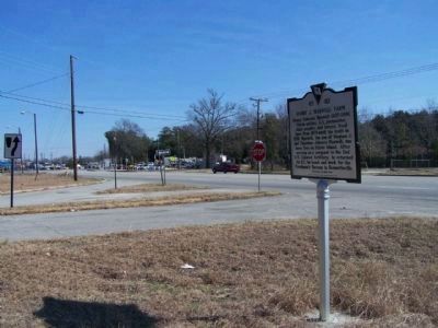
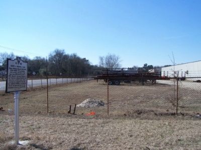
Location. 33° 53.612′ N, 80° 20.482′ W. Marker is in Sumter, South Carolina, in Sumter County. Marker is at the intersection of Pocalla Road ( U.S. 15) and Maxwell Avenue, on the left when traveling north on Pocalla Road. Touch for map. Marker is in this post office area: Sumter SC 29150, United States of America. Touch for directions.
Other nearby markers. At least 8 other markers are within 2 miles of this marker, measured as the crow flies. Battle of Dingle's Mill (approx. 1.3 miles away); a different marker also named Battle of Dingles Mill (approx. 1.3 miles away); Site of The Battle of Dingle's Mill (approx. 1.3 miles away); Kendall Institute (approx. 1.3 miles away); First Baptist Church (approx. 1˝ miles away); Mount Pisgah African Methodist Episcopal Church (approx. 1.7 miles away); Lincoln High School (approx. 1.8 miles away); Clara Louise Kellogg (approx. 1.8 miles away). Touch for a list and map of all markers in Sumter.
Regarding Henry J. Maxwell Farm. On March 3, 1865, Congress established the Bureau of Refugees, Freedmen, and Abandoned Lands, which was more commonly known as the Freedmen's Bureau. It was to be in service for only one year but, on July 16, 1866, Congress extended the life of the bureau despite the veto by President Andrew Johnson. The bureau's main focus was to provide food and medical care, to help the freedmen to resettle, to ensure justice for the freedmen, to manage abandoned or confiscated property, to regulate labor, and to establish schools. In many cases, it also provided aid for destitute whites.
Also see . . . The Bureau of Refugees, Freedmen, and Abandoned Lands. The bureau was run by the War Department, and its first and most important commissioner was General O.O. Howard, a Civil War hero. (Submitted on April 4, 2010, by Mike Stroud of Bluffton, South Carolina.)
Additional keywords. USCT
Credits. This page was last revised on December 15, 2019. It was originally submitted on April 4, 2010, by Mike Stroud of Bluffton, South Carolina. This page has been viewed 1,481 times since then and 43 times this year. Photos: 1, 2, 3, 4. submitted on April 4, 2010, by Mike Stroud of Bluffton, South Carolina. • Kevin W. was the editor who published this page.


