Goose Creek in Berkeley County, South Carolina — The American South (South Atlantic)
Goose Creek Bridge
The first bridge here, in use by 1680, had a raised road at either end and was built from split logs with the flat sides up, covered by sand or clay. Traffic over Goose Creek increased significantly after St. James, Goose Creek Church was built 200 yds. S in 1714-19. By the 1750s the bridge had to be replaced every few years. In 1780 British troops occupying The Oaks Plantation nearby guarded the bridge, a strategic point on the road to and from Charleston.
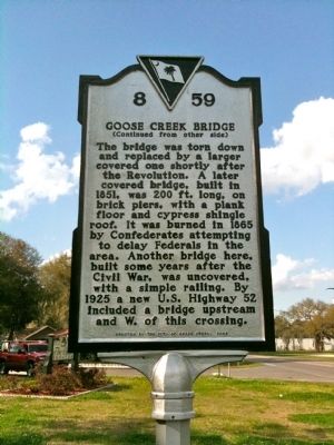
The bridge was torn down and replaced by a larger covered one shortly after the Revolution. A later covered bridge, built in 1851, was 200 ft. long, on brick piers, with a plank floor and cypress shingle roof. It was burned in 1865 by Confederates attempting to delay Federals in the area. Another bridge here, built some years after the Civil War, was uncovered, with a simple railing. By 1925 a new U.S. Highway 52 included a bridge upstream and W. of this crossing.
Erected 2008 by the City of Goose Creek. (Marker Number 8-59.)
Topics. This historical marker is listed in these topic lists: Bridges & Viaducts • War, US Civil. A significant historical year for this entry is 1680.
Location. 32° 58.85′ N, 80° 1.961′ W. Marker is in Goose Creek, South Carolina, in Berkeley County . Marker is on Old State Road, on the right when traveling south. Touch for map. Marker is in this post office area: Goose Creek SC 29445, United States of America. Touch for directions.
Other nearby markers. At least 8 other markers are within 2 miles of this marker, measured as the crow flies. Goose Creek Church (approx. ¼ mile away); The Oaks (approx. ¼ mile away); Howe Hall Plantation / Howe Hall Elementary School (approx. 0.3 miles away); St. James, Goose Creek (approx. 0.4 miles away); The Yamasee War At Goose Creek, 1715 (approx. 0.6 miles away); Boochawee Hall (approx. 1.1 miles away); Otranto Plantation (approx. 1.2 miles away); Goose Creek / City of Goose Creek (approx. 1.4 miles away). Touch for a list and map of all markers in Goose Creek.
Credits. This page was last revised on April 6, 2022. It was originally submitted on April 4, 2010, by David Bullard of Seneca, South Carolina. This page has been viewed 2,721 times since then and 196 times this year. Photos: 1, 2. submitted on April 4, 2010, by David Bullard of Seneca, South Carolina. • Craig Swain was the editor who published this page.

