Marker Logo HMdb.org THE HISTORICAL
MARKER DATABASE
“Bite-Size Bits of Local, National, and Global History”
Bishop in Inyo County, California — The American West (Pacific Coastal)
 

Pine Creek Mine


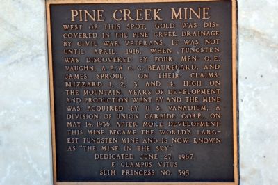
Pine Creek Mine Marker image. Click for full size.
Photographed By Karen Key, August 25, 2007
1. Pine Creek Mine Marker
Inscription. West of this spot, gold was discovered in the Pine Creek drainage by Civil War veterans. It was not until April, 1916, when tungsten was discovered by four men: O.E. Vaughn, A.E. & C.C. Beauregard, and James Sproul on their claims, Blizzard 1, 2, 3 and 4, high on the mountain. Years of development and production went by and the mine was acquired by U.S. Vanadium, a division of Union Carbide Corp., on May 14, 1936. After more development, this mine became the world’s largest tungsten mine and is now known as “the Mine in the Sky”.

Dedicated June 27, 1987
E Clampus Vitus
Slim Princess No. 395

 
Erected 1987 by E Clampus Vitus Slim Princess No. 395.
 
Topics and series. This historical marker is listed in this topic list: Industry & Commerce. In addition, it is included in the E Clampus Vitus series list. A significant historical date for this entry is April 14, 1916.
 
Location. 37° 26.6′ N, 118° 34.35′ W. Marker is in Bishop, California, in Inyo County. Marker is on Highway 395, on the right when traveling south. Marker is at a highway vista point pullout. Touch for map. Marker is in this post office area: Bishop CA 93514, United States of America. Touch for directions.
 
Other nearby markers. At least 8 other markers are within 12 miles of this marker, measured as the crow flies. Owens Valley (approx. 5˝ miles away); Lynching of the Convicts
Paid Advertisement
Click on the ad for more information.
Please report objectionable advertising to the Editor.
Click or scan to see
this page online
(approx. 8 miles away); Buttermilk Road (approx. 8.1 miles away); Bishop Creek Battleground (approx. 8.6 miles away); San Francis Ranch (approx. 8.7 miles away); The Mule (approx. 10.7 miles away); "Atlas Copco Mucker" (approx. 11.1 miles away); The Little Kittie Inn (approx. 11.2 miles away). Touch for a list and map of all markers in Bishop.
 
Also see . . .
1. George Brown: A Man For The People. George Brown, Native American, Owens Valley Pioneer, Founder of the Pine Creek Pack Station (Submitted on October 14, 2007, by Karen Key of Sacramento, California.) 

2. Tungsten. (Submitted on October 14, 2007, by Karen Key of Sacramento, California.)
 
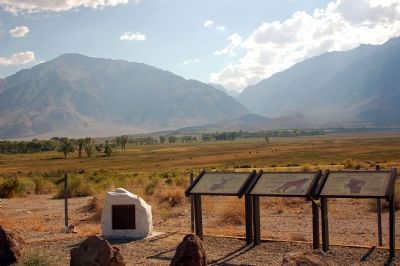
Pine Creek Mine Marker and Others image. Click for full size.
Photographed By Karen Key, August 25, 2007
2. Pine Creek Mine Marker and Others
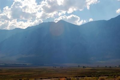
View from Pine Creek Mine Marker image. Click for full size.
Photographed By Karen Key, August 25, 2007
3. View from Pine Creek Mine Marker
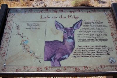
“Life on the Edge” Deer Marker image. Click for full size.
Photographed By Karen Key, August 25, 2007
4. “Life on the Edge” Deer Marker
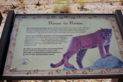
“Room to Roam” Mountain Lion Marker image. Click for full size.
Photographed By Karen Key, August 25, 2007
5. “Room to Roam” Mountain Lion Marker
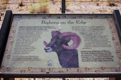
"Bighorn on the Edge” Bighorn Sheep Marker image. Click for full size.
Photographed By Karen Key, August 25, 2007
6. "Bighorn on the Edge” Bighorn Sheep Marker
 
 
Credits. This page was last revised on January 5, 2020. It was originally submitted on October 14, 2007, by Karen Key of Sacramento, California. This page has been viewed 3,302 times since then and 48 times this year. Photos:   1, 2, 3, 4, 5, 6. submitted on October 14, 2007, by Karen Key of Sacramento, California. • J. J. Prats was the editor who published this page.
Share this page.  
Share on Tumblr
m=2952

CeraNet Cloud Computing sponsors the Historical Marker Database.
This website earns income from purchases you make after using our links to Amazon.com. We appreciate your support.
Paid Advertisement
Apr. 19, 2024