South Berkeley in Alameda County, California — The American West (Pacific Coastal)
Davis-Byrne Building
1895
— City of Berkeley Landmark - Designated 1991 —
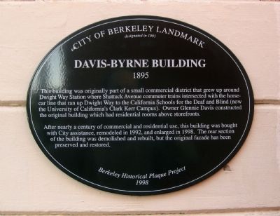
This building was originally part of the small commercial district that grew up around Dwight Way Station where Shattuck Avenue commuter trains intersected with the horse-car line that ran up Dwight Way to the California Schools for the Deaf and Blind (now the University of California's Clark Kerr Campus). Owner Glennie Davis constructed the original building which had residential rooms above storefronts.
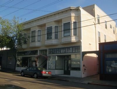
After nearly a century of residential and commercial use, this building was bought with City assistance, remodeled in 1992, and enlarged in 1998. The rear section of the building was demolished and rebuilt, but the original facade has been preserved and restored.
Erected 1998 by Berkeley Historical Plaque Project.
Topics. This historical marker is listed in these topic lists: Architecture • Industry & Commerce • Railroads & Streetcars. A significant historical year for this entry is 1992.
Location. 37° 51.845′ N, 122° 15.965′ W. Marker is in Berkeley, California, in Alameda County. It is in South Berkeley. Marker is on Dwight Way, on the right when traveling east. Touch for map. Marker is at or near this postal address: 2134 Dwight Way, Berkeley CA 94704, United States of America. Touch for directions.
Other nearby markers. At least 8 other markers are within walking distance of this marker. Barker Building (about 500 feet away, measured in a direct line); The Shuman Block (about 500 feet away); Howard Automobile Company (approx. 0.2 miles away); g. Paul Bishop Studio (approx. 0.2 miles away); Charles W. Woodworth House (approx. ¼ mile away); Morse Block (approx. 0.3 miles away); McCreary-Greer House (approx. 0.3 miles away); Tupper & Reed Building (approx. 0.3 miles away). Touch for a list and map of all markers in Berkeley.
Regarding Davis-Byrne Building. Additional information from the Historic American Building Survey notes for this structure:
• Construction of the building began in 1895, with a total construction cost of $1,363.
• The contractor for construction was Anderson and Greig. HABS notes that although an 1895 construction notice lists the owner, Glennie Davis, as the architect, it was likely that the contractor was also the architect, as it was common practice at the time to list the owner as architect, and Davis (a bookkeeper) had no known experience in architecture.
• The building was partially destroyed by fire on May 23, 1902, and subsequently rebuilt. According to the newspaper report of the time, the fire may have
been set to drive out the Chinese businesses next door.

Photographed By David G. De Vries, September 1991
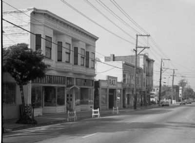
3. Davis-Byrne Building Streetscape (circa 1991), courtesy of the Historic American Building Survey
Statement of Significance from HABS: The Davis-Byrne Building is a characteristic example of a once-common building type distinguished by its unusually high degree of integrity, including its unaltered storefronts. As a building type, it represents the long tradition of housing over shops as it was adopted in streetcar cities. It is an important surviving element in Dwight Way Station, a neighborhood commercial area that arose and flourished as a steam train and electric streetcar stop. This is a characteristic but rarely documented example of the housing patterns of small shopkeepers and working-class people as those patterns changed during the 20th century.
Credits. This page was last revised on February 7, 2023. It was originally submitted on April 7, 2010, by Andrew Ruppenstein of Lamorinda, California. This page has been viewed 1,119 times since then and 28 times this year. Photos: 1, 2, 3. submitted on April 7, 2010, by Andrew Ruppenstein of Lamorinda, California. • Syd Whittle was the editor who published this page.

