Johns Island in Charleston County, South Carolina — The American South (South Atlantic)
Federal Expedition on John's Island / Battle of Burden's Causeway
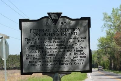
Federal Expedition on John's Island
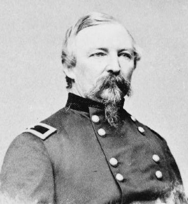
The Battle of Burdenís Causeway was the climax of a Federal expedition against Johnís Island, July 2-9, 1864. 5000 Federals under Brig. Gen. John P. Hatch crossed the Stono River and advanced along it. By July 6th they occupied a strong position here, where a bridge on Burdenís Causeway crossed Burdenís Creek.
(Reverse text)
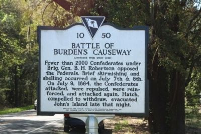
Battle of Burden's Causeway
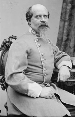
Fewer than 2000 Confederates under Brig. Gen. B.H. Robertson opposed the Federals. Brief skirmishing and shelling occurred on July 7th and 8th. On July 9, 1864, the Confederates attacked, were repulsed, were reinforced, and attacked again. Hatch, compelled to withdraw, evacuated Johnís Island late that night.
Erected 2006 by The Carolina Historical Site Preservation Foundation, Inc., and Secession Camp #4, Sons of Confederate Veterans. (Marker Number 10-50.)
Topics and series. This historical marker is listed in this topic list: War, US Civil. In addition, it is included in the Sons of Confederate Veterans/United Confederate Veterans series list. A significant historical month for this entry is July 1740.
Location. 32° 43.108′ N, 80° 1.295′ W. Marker is on Johns Island, South Carolina, in Charleston County . Marker is at the intersection of River Road and Plow Ground Road (South Carolina Highway 10-1156), on the right when traveling south on River Road. Touch for map. Marker is at or near this postal address: 2805 State Rd S-10-1156, Johns Island SC 29455, United States of America. Touch for directions.
Other nearby markers. At least 8 other markers are within 5 miles of this marker, measured as the crow flies. The Progressive Club (approx. 3.1 miles away); Hunter's Volunteers (approx. 3.1 miles away); Battery Number 5 (approx. 4 miles away); Battle of Sol-Legare Island (approx. 4.1 miles away); John's Island Presbyterian Church (approx. 4.2 miles away); Mosquito Beach (approx. 4.2 miles away); Battery Reed (approx. 4.4 miles away); Secessionville (approx. 4Ĺ miles away). Touch for a list and map of all markers in Johns Island.
Also see . . . John Porter Hatch. In 1864, he was assigned to the Department of the South, where he had charge of the coast division. He was in charge of operations on John's Island, South Carolina, in July and led the Federal forces at the Battle of Honey Hill in November. (Submitted on April 8, 2010, by Mike Stroud of Bluffton, South Carolina.)
Credits. This page was last revised on December 5, 2020. It was originally submitted on April 8, 2010, by Mike Stroud of Bluffton, South Carolina. This page has been viewed 3,633 times since then and 114 times this year. Photos: 1, 2, 3, 4, 5. submitted on April 8, 2010, by Mike Stroud of Bluffton, South Carolina. 6. submitted on April 9, 2010, by Michael Sean Nix of Spartanburg, South Carolina. • Craig Swain was the editor who published this page.
