Front Royal in Warren County, Virginia — The American South (Mid-Atlantic)
Bel Air
Home of Lucy Buck, Diarist
— Battle of Front Royal - May 23, 1862 —
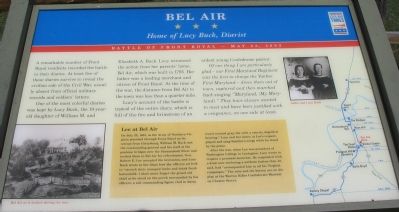
A remarkable number of Front Royal residents recorded the battle in their diaries. At least five of these diaries survive to reveal the civilian side of the Civil War, usually absent from official military records or soldiers' letters.
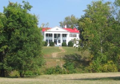
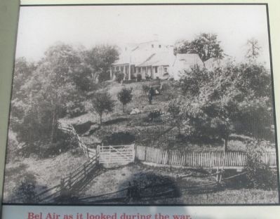
One of the most colorful diaries was kept by Lucy Buck, the 19-year-old daughter of William M. and Elizabeth A. Buck. Lucy witnessed the action from her parents' home, Bel Air, which was built in 1795. Her father was a leading merchant and citizen of Front Royal. At the time of the war, the distance from Bel Air to the town was less than a quarter mile.
Lucy's account of the battle is typical of the entire diary, which is full of the fire and brimstone of an ardent young Confederate patriot:
Of one thing I am particularly glad - our First Maryland Regiment was the first to charge the Yankee First Maryland - drove them out of town, captured and then marched back singing "Maryland, (My Maryland)." They have always wanted to meet and have been justified with a vengeance, on one side at least.
(Lower Center Sidebar): Lee at Bel Air
On July 22, 1863, as the Army of Northern Virginia marched through Front Royal on its retreat from Gettysburg, William M. Buck met the commanding general and his staff at the pontoon bridges over the Shenandoah River and invited them to Bel Air for refreshment. Gen. Robert E. Lee accepted the invitation, and Lucy Buck wrote in her diary how the officers arrived to "stretch their cramped limbs and drink fresh buttermilk. I shall never forget the grand old chief as he stood on the porch surrounded by his officers; a tall commanding figure clad in dusty, travel-stained gray but with a courtly, dignified bearing." Lucy and her sister, at Lee's request, played and sang Southern songs while he stood by the piano.
After the war, when Lee was president of Washington College in Lexington, Lucy wrote to request a personal momento. He responded with a kind note enclosing a uniform button that, he said, had "accompanied him in all his Virginia campaigns." The note and the button are on display at the Warren Rifles Confederate Museum on Chester Street.
Erected by Civil War Trails.
Topics and series. This historical marker is listed in this topic list: War, US Civil. In addition, it is included in the Virginia Civil War Trails series list. A significant historical month for this entry is July 1755.
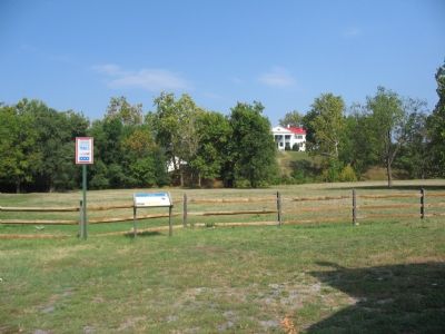
Location. 38° 55.202′ N, 78° 11.317′ W. Marker is in Front Royal, Virginia, in Warren County. Marker is on Water Street, on the right. Located behind the LeHaw Well Drilling Company at the end of Water Street. Touch for map. Marker is in this post office area: Front Royal VA 22630, United States of America. Touch for directions.
Other nearby markers.
At least 8 other markers are within walking distance of this marker. Erin Dinner Bell (about 700 feet away, measured in a direct line); The Great Seal of the Confederacy (about 800 feet away); Williams Chapel (approx. 0.2 miles away); Front Royal (approx. 0.2 miles away); Site of Lane's Tavern (approx. 0.2 miles away); The Courthouse (approx. ¼ mile away); Capture of Front Royal (approx. ¼ mile away); Warren County Korea & Vietnam Memorial (approx. 0.3 miles away). Touch for a list and map of all markers in Front Royal.
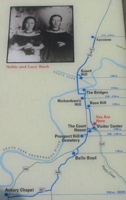
More about this marker. On the right side, the marker displays a map of the Battle of Front Royal with emphasis on the Civil War Trails tour stops. A portrait of Nellie and Lucy Buck is in the upper portion of the map. On the lower left is a photo of "Bel Air as it looked during the war."
Regarding Bel Air. This marker is one of several from a driving tour of the Front Royal Battlefield. The markers are listed in sequence on the Battle of Front Royal Virtual Tour by Markers link below.
Also see . . .
1. Battle of Front Royal. National Park Service website entry (Submitted on October 14, 2007, by Craig Swain of Leesburg, Virginia.)
2. Battle of Front Royal Virtual Tour by HMDb Markers. (Submitted on November 18, 2007, by Craig Swain of Leesburg, Virginia.)
Credits. This page was last revised on August 14, 2022. It was originally submitted on October 14, 2007, by Craig Swain of Leesburg, Virginia. This page has been viewed 3,263 times since then and 56 times this year. Photos: 1, 2, 3, 4, 5. submitted on October 14, 2007, by Craig Swain of Leesburg, Virginia.
