Moon in Mathews County, Virginia — The American South (Mid-Atlantic)
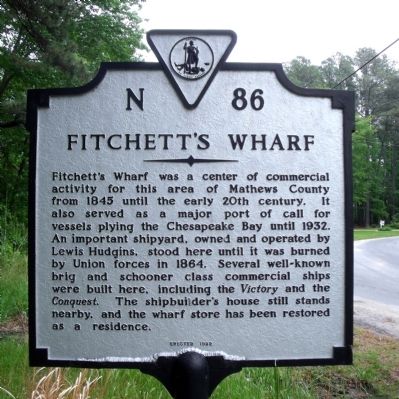
Fitchett's Wharf
Erected 1982 by Virginia Department of Historic Resources. (Marker Number N-86.)
Topics and series. This historical marker is listed in these topic lists: Industry & Commerce • War, US Civil • Waterways & Vessels. In addition, it is included in the Virginia Department of Historic Resources (DHR) series list. A significant historical year for this entry is 1845.
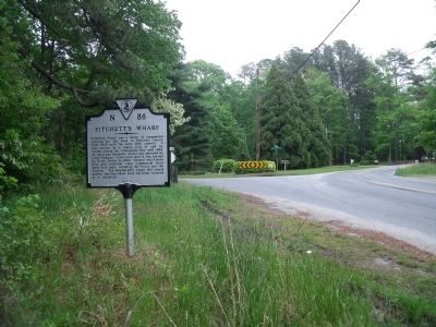
Location. 37° 26.627′ N, 76° 17.602′ W. Marker is in Moon, Virginia, in Mathews County. Marker is at the intersection of Fitchetts Wharf Road (Virginia Route 642) and Haven Beach Road (Virginia Route 643), on the left when traveling east on Fitchetts Wharf Road. Touch for map. Marker is in this post office area: Moon VA 23119, United States of America. Touch for directions.
Other nearby markers. At least 8 other markers are within 2 miles of this marker, measured as the crow flies. Veterans Memorial (approx. 1.6 miles away); Mathews County Confederate Monument (approx. 1.7 miles away); Captain Sally L. Tompkins, C.S.A. (approx. 1.7 miles away); Mathews County Courthouse Square (approx. 1.7 miles away); Civil War In Mathews County (approx. 1.7 miles away); Fort Cricket Hill (approx. 1.7 miles away); Tompkins Cottage Museum (approx. 1.7 miles away); Thomas Hunter (Rosenwald) School (approx. 1.9 miles away).
Credits. This page was last revised on July 8, 2021. It was originally submitted on April 26, 2010, by Bernard Fisher of Richmond, Virginia. This page has been viewed 1,251 times since then and 20 times this year. Photos: 1, 2. submitted on April 26, 2010, by Bernard Fisher of Richmond, Virginia.

