Uniontown in Carroll County, Maryland — The American Northeast (Mid-Atlantic)
Uniontown
“Patriotic, but Paralyzed”
— Gettysburg Campaign —
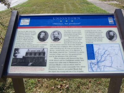
Hancock was ordered to march northeast toward Frizzelburg at 4 a.m. on June 29, but did not put his corps in motion until four hours later because the orders were misplaced. After a 32-mile march under a broiling sun, II Corps arrived here at 10 p.m., several miles short of its objective. A New Yorker observed that “Uniontown is a pretty secluded village, patriotic, but paralyzed just now by the nearness of the rebel army.”
When residents told Hancock that Gen. J. E. B. Stuart and his Confederate cavalry were camped four miles away in Westminster, he informed Meade so that an attack could be launched. Union cavalry commander Gen. Alfred Pleasonton, however, persuaded Meade that the report was wrong and two of his brigades occupied the town. In fact, it was Hancock who was correct, and Stuart, unaware of the Federal infantry in Uniontown, might have been defeated had the Federals attacked on the morning of June 30.
Topics and series. This historical marker is listed in this topic list: War, US Civil. In addition, it is included in the Maryland Civil War Trails series list. A significant historical month for this entry is June 2003.
Location. 39° 35.592′ N, 77° 7.015′ W. Marker is in Uniontown, Maryland, in Carroll County. Marker is on Uniontown Road, 0.1 miles Maryland Route 84, on the right when traveling east. Touch for map. Marker is in this post office area: Westminster MD 21158, United States of America. Touch for directions.
Other nearby markers. At least 8 other markers are within 4 miles of this marker, measured as the crow flies. Army of the Potomac (about 400 feet away, measured in a direct line); Weaver - Fox House (about 700 feet away); The John Hyder House and Post Office (approx. 0.2 miles away); Historic Uniontown (approx. 0.6 miles away); Headquarters Second Corps Army of the Potomac (approx. 1.3 miles away); Elmer A. Wolfe High School (approx. 3.4 miles away); “Pipe Creek Meeting” (approx. 3˝ miles away); Gen. Bradley T. Johnson's Raid (approx. 3˝ miles away). Touch for a list and map of all markers in Uniontown.
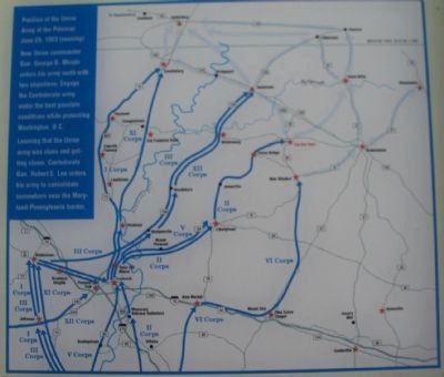
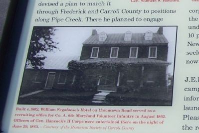
More about this marker. In the center of the marker are portraits of Gens. Hancock and Pleasonton. On the far right is a portrait of Confederate Gen. J.E.B. Stuart. On the lower left is a photo of the Segafoose Hotel. On the lower right is a campaign
Photographed By William Pfingsten, October 14, 2007
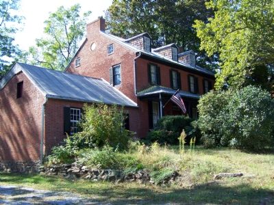
2. William Segafoose Hotel
Built c 1802, William Segafoose's Hotel on Uniontown Road served as a recruiting office for Co. A, 6th Maryland Volunteer Infantry in August 1862. Officers of Gen. Hancock's II Corps were entertained there on the night of June 29, 1863.
Courtesy of Historical Society of Carroll County
Credits. This page was last revised on June 16, 2016. It was originally submitted on October 16, 2007, by Bill Pfingsten of Bel Air, Maryland. This page has been viewed 2,395 times since then and 62 times this year. Photos: 1, 2, 3. submitted on October 16, 2007, by Bill Pfingsten of Bel Air, Maryland. 4. submitted on April 4, 2010, by Craig Swain of Leesburg, Virginia. 5. submitted on October 16, 2007, by Bill Pfingsten of Bel Air, Maryland. • J. J. Prats was the editor who published this page.
