Columbia in Richland County, South Carolina — The American South (South Atlantic)
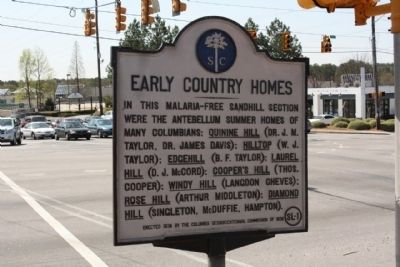
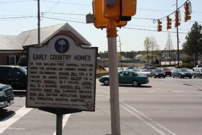
Early Country Homes
Erected 1938 by The Columbia Sesquicentennial Commission of 1936. (Marker Number 40-39.)
Topics. This historical marker is listed in this topic list: Notable Places.
Location. 34° 1.158′ N, 80° 59.379′ W. Marker is in Columbia, South Carolina, in Richland County. Marker is at the intersection of Forest Drive (State Highway 12) and North Beltline Blvd (State Highway 16), on the right when traveling west on Forest Drive. Located in the Forest Acres Community of Columbia. Touch for map. Marker is in this post office area: Columbia SC 29204, United States of America. Touch for directions.
Other nearby markers. At least 8 other markers are within 2 miles of this marker, measured as the crow flies. Diamond Hill (approx. 1.1 miles away); Bethel Methodist Church (approx. 1.1 miles away); South Carolina Female Collegiate Institute (approx. 1.3 miles away); Paul R. Redfern (approx. 1˝ miles away); Fisher's Mill on Gill Creek (approx. 1˝ miles away); Redfern Field / Paul R. Redfern (approx. 1˝ miles away); Early Columbia Racetrack (approx. 1.6 miles away); Heidt - Russell House / Edwin R. Russell (approx. 1.6 miles away). Touch for a list and map of all markers in Columbia.
Credits. This page was last revised on June 16, 2016. It was originally submitted on April 30, 2010, by Mike Stroud of Bluffton, South Carolina. This page has been viewed 1,169 times since then and 36 times this year. Photos: 1, 2. submitted on April 30, 2010, by Mike Stroud of Bluffton, South Carolina.

