Main/Military Plaza in San Antonio in Bexar County, Texas — The American South (West South Central)
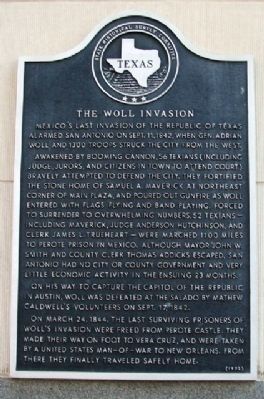
The Woll Invasion
Mexico’s last invasion of the Republic of Texas alarmed San Antonio on Sept. 11, 1842, when Gen. Adrian Woll and 1300 troops struck the city from the west.
Awakened by booming cannon, 56 Texians (including judge, jurors, and citizens in town to attend court) bravely attempted to defend the city. They fortified the stone home of Samuel A. Maverick at northeast corner of Main Plaza, and poured out gunfire as Woll entered with flags flying and band playing. Forced to surrender to overwhelming numbers, 52 Texians – including Maverick, Judge Anderson Hutchinson, and Clerk James L. Trueheart – were marched 1100 miles to Perote Prison in Mexico. Although Mayor John W. Smith and County Clerk Thomas Addicks escaped, San Antonio had no city or county government and very little economic activity in the ensuing 23 months.
On his way to capture the Capitol of the Republic in Austin, Woll was defeated at the Salado by Mathew Caldwell’s volunteers on Sept. 17, 1842.
On March 24, 1844, the last surviving prisoners of Woll’s invasion were freed from Perote Castle. They made their way on foot to Vera Cruz, and were taken by a United States man-of-war to New Orleans. From there they finally traveled safely home.
Erected 1972 by State Historical Survey Committee. (Marker Number 5888.)
Topics. This historical marker is listed in these topic lists: Patriots & Patriotism • Settlements & Settlers • War, Texas Independence. A significant historical month for this entry is March 1864.
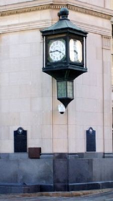
Location. 29° 25.497′ N, 98° 29.634′ W. Marker is in San Antonio, Texas, in Bexar County. It is in Main/Military Plaza. Marker is at the intersection of Commerce Street and Main Avenue, on the left when traveling west on Commerce Street. Marker is on the wall near the NE corner of the Municipal Plaza Building. Touch for map. Marker is at or near this postal address: 114 W Commerce Street, San Antonio TX 78205, United States of America. Touch for directions.
Other nearby markers. At least 8 other markers are within walking distance of this marker. General David E. Twiggs (here, next to this marker); T.C. Frost and the Frost Bank (a few steps from this marker); Main Plaza - Plaza de las Islas (a few steps from this marker); Civil War Centennial 1861 - 1961 (a few steps from this marker); Cock Fighting (within shouting distance of this marker); White Elephant (within shouting distance of this marker); Games of Chance (within shouting distance of this marker); The Old Cathedral (within shouting distance of this marker). Touch for a list and map of all markers in San Antonio.
Credits. This page was last revised on February 2, 2023. It was originally submitted on May 2, 2010, by William Fischer, Jr. of Scranton, Pennsylvania. This page has been viewed 1,940 times since then and 251 times this year. Photos: 1, 2, 3. submitted on May 2, 2010, by William Fischer, Jr. of Scranton, Pennsylvania.


