Dahlonega in Lumpkin County, Georgia — The American South (South Atlantic)
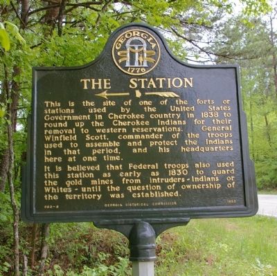
The Station
<---------<<<
It is believed that Federal troops also used this station as early as 1830 to guard the gold mines from intruders -- Indians or Whites -- until the question of ownership of the territory was established.
Erected 1953 by Georgia Historical Commission. (Marker Number 093-6.)
Topics and series. This historical marker is listed in these topic lists: Forts and Castles • Industry & Commerce • Native Americans • Wars, US Indian. In addition, it is included in the Georgia Historical Society, and the Trail of Tears series lists. A significant historical year for this entry is 1838.
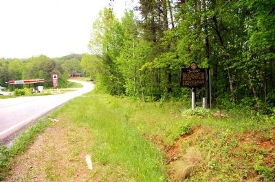
Location. 34° 29.32′ N, 84° 1.198′ W. Marker is in Dahlonega, Georgia, in Lumpkin County. Marker is at the intersection of Autaria Road (Georgia Route 9E) and Tanner Drive, on the right when traveling north on Autaria Road. Touch for map. Marker is in this post office area: Dahlonega GA 30533, United States of America. Touch for directions.
Other nearby markers. At least 8 other markers are within 4 miles of this marker , measured as the crow flies. Auraria (approx. one mile away); Calhoun Gold Mine (approx. 2.7 miles away); Mt. Hope Cemetery (approx. 3.2 miles away); Dahlonega Mint (approx. 3.4 miles away); Price Memorial Building (approx. 3.4 miles away); U.A. Lawson Steeple (approx. 3.4 miles away); William Pierce Price (approx. 3.4 miles away); a different marker also named Price Memorial Building (approx. 3.4 miles away). Touch for a list and map of all markers in Dahlonega.
Additional keywords. Gold
Credits. This page was last revised on January 31, 2020. It was originally submitted on May 4, 2010, by David Seibert of Sandy Springs, Georgia. This page has been viewed 1,822 times since then and 45 times this year. Photos: 1, 2, 3, 4. submitted on May 4, 2010, by David Seibert of Sandy Springs, Georgia. • Kevin W. was the editor who published this page.


