Kennedyville in Kent County, Maryland — The American Northeast (Mid-Atlantic)
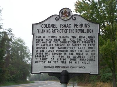
Colonel Isaac Perkins
“Flaming Patriot” of the Revolution
Inscription.
Son of Thomas Perkins, who built brick house near here in 1720. The Colonel was one of the commissioners appointed by Maryland Council of Safety to raise supplies for Washington’s army. Much of the flour provided from the Eastern Shore was ground in the mills of his property. In 1780 he accused Tory “villains” of hiring “some abandoned wretch” to set fire to his mills.
Topics. This historical marker is listed in these topic lists: Colonial Era • Industry & Commerce • Patriots & Patriotism • War, US Revolutionary. A significant historical year for this entry is 1720.
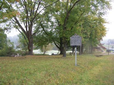
Location. 39° 16.727′ N, 76° 1.548′ W. Marker is in Kennedyville, Maryland, in Kent County. Marker is on Maryland Route 213, on the right when traveling south. Marker is in the Urieville Pond picnic area. Touch for map. Marker is in this post office area: Kennedyville MD 21645, United States of America. Touch for directions.
Other nearby markers. At least 8 other markers are within 6 miles of this marker, measured as the crow flies. Maryland’s First Women Voters (approx. 3½ miles away); Christ Episcopal IU Church and Cemetery (approx. 3.6 miles away); Taking Command (approx. 3.7 miles away); Brig. Gen. John Cadwalader (approx. 4.6 miles away); George Washington (approx. 4.8 miles away); a different marker also named George Washington (approx. 4.8 miles away); Washington College (approx. 4.9 miles away); The Kent County Free School (approx. 5.1 miles away).
Credits. This page was last revised on January 30, 2019. It was originally submitted on October 18, 2007, by Bill Pfingsten of Bel Air, Maryland. This page has been viewed 1,754 times since then and 60 times this year. Last updated on January 26, 2019, by Carl Gordon Moore Jr. of North East, Maryland. Photos: 1, 2. submitted on October 18, 2007, by Bill Pfingsten of Bel Air, Maryland.

