Manistee Ranch HOA in Glendale in Maricopa County, Arizona — The American Mountains (Southwest)
Manistee Ranch
of Historic Places
Listed April 9, 1998
United Stated
Department of the Interior
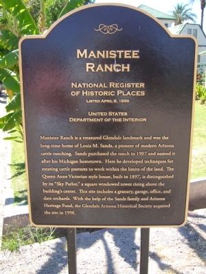
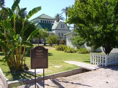
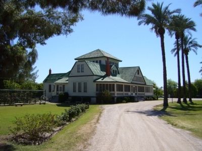
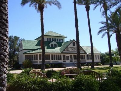
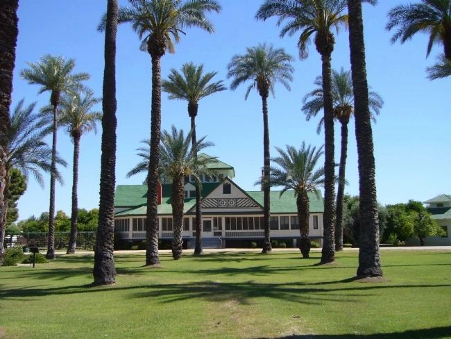
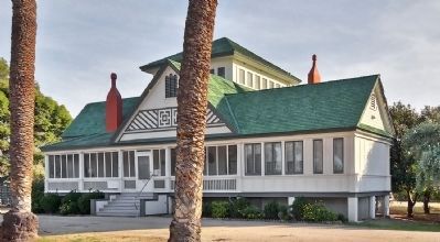
Manistee Ranch a treasured Glendale landmark and was the long-time home of Louis M. Sands, a pioneer of modern Arizona cattle ranching. Sands purchased the ranch in 1907 and named it after his Michigan hometown. Here he developed techniques for rotating cattle pastures to work within the limits of the land. The Queen Anne Victorian style house, built in 1897, is distinguished by its "Sky Parlor," a square windowed tower rising above the building's center. This site includes a granary, garage, office, and date orchards. With the help of the Sands family and Arizona Heritage Fund, the Glendale Arizona Historical Society acquired the site in 1996.
Topics. This historical marker is listed in these topic lists: Agriculture • Notable Buildings • Notable Places. A significant historical date for this entry is April 9, 1998.
Location. 33° 33.092′ N, 112° 10.204′ W. Marker is in Glendale, Arizona, in Maricopa County. It is in Manistee Ranch HOA. Marker can be reached from North 51st Avenue. Marker is just west of the visitors parking area of the Manistee Ranch Park. Touch for map. Marker is at or near this postal address: 5127 West Northern Avenue, Glendale AZ 85301, United States of America. Touch for directions.
Other nearby markers. At least 8 other markers are within 2 miles of this marker, measured as the crow flies. Glendale Woman's Club Clubhouse (approx. one mile away); 59th Avenue Residential Historic District (approx. one mile away); Glendale Townsite (approx. 1.1 miles away); Floralcroft Historic District (approx. 1.1 miles away); Catlin Court Historic District (approx. 1.1 miles away); Glendale Business District (approx. 1.1 miles away); Murphy Park (approx. 1.1 miles away); Methodist Episcopal Church of Glendale Sanctuary (approx. 1.2 miles away). Touch for a list and map of all markers in Glendale.
Also see . . . Manistee Ranch Park. The Park's website details the history of the ranch, programs offered and additional photos. (Submitted on May 11, 2010.)
Credits. This page was last revised on February 2, 2023. It was originally submitted on May 9, 2010, by Bill Kirchner of Tucson, Arizona. This page has been viewed 2,009 times since then and 49 times this year. Photos: 1, 2, 3, 4, 5. submitted on May 9, 2010, by Bill Kirchner of Tucson, Arizona. 6. submitted on January 14, 2011, by Michael D Martin of Gig Harbor, Washington. • Syd Whittle was the editor who published this page.
