Kinston in Lenoir County, North Carolina — The American South (South Atlantic)
North Carolina
Civil War Trails
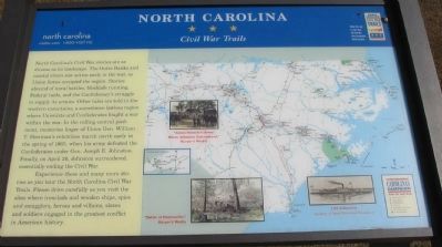
North Carolina's Civil War stories are as diverse as its landscape. The Outer Banks and coastal rivers saw action early in the war, as Union forces occupied the region. Stories abound of naval battles, blockade running, Federal raids, and the Confederacy's struggle to supply its armies. Other tales are told in the western mountains, a sometimes-lawless region where Unionists and Confederates fought a war within a war. In the rolling central piedmont, memories linger of Union Gen. William T. Sherman's relentless march north early in the spring of 1865, when his army defeated the Confederates under Gen. Joseph E. Johnston. Finally, on April 26, Johnston surrendered, essentially ending the Civil War.
Experience these and many more stories as you tour the North Carolina Civil War Trails. Please drive carefully as you visit the sites where ironclads and wooden ships, spies and smugglers, heroes and villains, slaves and soldiers engaged in the greatest conflict in American history.
Erected by North Carolina Civil War Trails.
Topics and series. This historical marker is listed in this topic list: War, US Civil. In addition, it is included in the North Carolina Civil War Trails series list. A significant historical year for this entry is 1865.
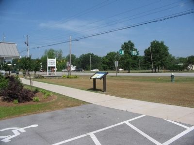
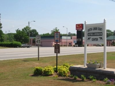
Location. 35° 14.634′ N, 77° 35.045′ W. Marker is in Kinston, North Carolina, in Lenoir County. Marker is at the intersection of East New Bern Road (U.S. 70) and Richlands Road (U.S. 258), on the right when traveling east on East New Bern Road. Located at the Kinston-Lenoir County Visitor Information Center. Touch for map. Marker is in this post office area: Kinston NC 28504, United States of America. Touch for directions.
Other nearby markers. At least 8 other markers are within walking distance of this marker. Richard Caswell Gatlin (a few steps from this marker); Foster's Raid (about 300 feet away, measured in a direct line); Battle of Kinston (about 500 feet away); First Battle of Kinston (approx. ¼ mile away); The Night of December 13, 1862 (approx. ¼ mile away); Kinston Battlefield Park (approx. ¼ mile away); Fighting at Harriet's Chapel (approx. ¼ mile away); The Site of Harriet's Chapel (approx. ¼ mile away). Touch for a list and map of all markers in Kinston.
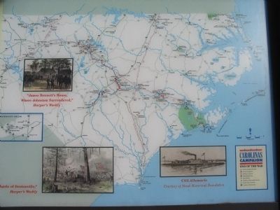
More about this marker. On the right half of the marker is a map of North Carolina showing locations of Civil War Trails sites. Inset illustrations include "James Bennett's House, where Johnston Surrendered", Battle of Bentonville, and CSS Albemarle.
Related markers. Click here for a list of markers that are related to this marker. To better understand the relationship, study each marker shown.
Also see . . . Explore Civil War Battlefields in Kinkson and Goldborough. Visit North Carolina website entry (Submitted on May 19, 2023, by Larry Gertner of New York, New York.)
Credits. This page was last revised on May 19, 2023. It was originally submitted on May 9, 2010, by Craig Swain of Leesburg, Virginia. This page has been viewed 1,166 times since then and 15 times this year. Photos: 1, 2, 3, 4. submitted on May 9, 2010, by Craig Swain of Leesburg, Virginia.


