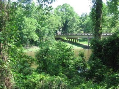
Seven Springs in Wayne County, North Carolina — The American South (South Atlantic)
Engagement at Whitehall
A Sharp Action
— Foster's Raid —
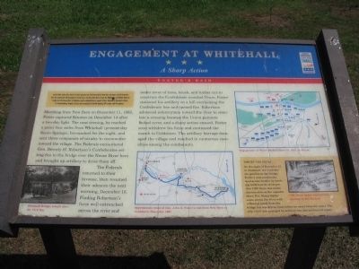
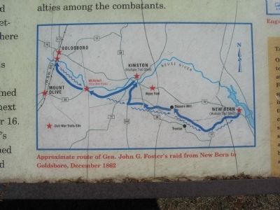
Marching from New Bern on December 11, 1862, Foster captured Kinston on December 14 after a two-day fight. The next evening, he reached a point four miles from Whitehall (present-day Seven Springs), bivouacked for the night, and sent three companies of cavalry to reconnoiter toward the village. The Federals encountered Gen. Beverly H. Robertson's Confederates setting fire to the bridge over the Neuse River here and brought up artillery to drive them off.
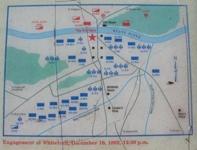
The Federals returned to their bivouac, then resumed their advance the next morning, December 16. Finding Robertson's force well entrenched across the river and under cover of trees, brush, and timber cut to construct the Confederate ironclad Neuse, Foster stationed his artillery on a hill overlooking the Confederate line and opened fire. Roberson advanced infantrymen toward the river to simulate a crossing because the Union gunners lacked cover, and a sharp action ensued. Foster soon withdrew his force and continued the march to Goldsboro. The artillery barrage damaged the village and resulted in numerous casualties among the combatants.
(Sidebar):
Target CSS Neuse
On the night of December 15, to illuminate the Confederate position at the bridge, Foster's men produced a spectacular bonfire by torching 2,000 barrels of turpentine. CSS Neuse was under construction on the opposite shore. Pvt. Henry Butler swam across the river with a flaming plank from the bridge but was driven back before he could burn the vessel. The ship's hull was damaged by artillery fire, but not beyond repair.
Erected by North Carolina Civil War Trails.
Topics and series. This historical marker is listed in this topic list: War, US Civil. In addition, it is included in the North Carolina Civil War Trails series list. A significant historical month for this entry is December 1864.
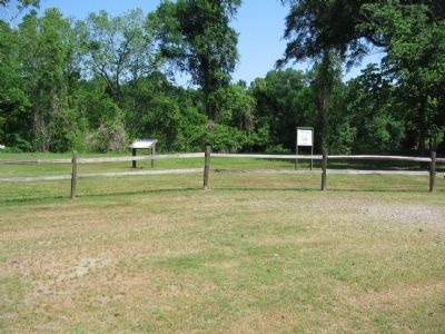
Location. 35° 13.704′ N, 77° 50.841′ W. Marker is in Seven Springs, North Carolina, in Wayne County. Marker is at the intersection of West River Street and New Street, on the right when traveling west on West River Street. Located in at Whitehall landing adjacent to the Whitefield Cemetery, next to the Neuse River. Touch for map. Marker is in this post office area: Seven Springs NC 28578, United States of America. Touch for directions.
Other nearby markers. At least 8 other markers are within 13 miles of this marker, measured as the crow flies. The Battle of Whitehall (about 400 feet away, measured in a direct line); Dobbs County Court House (approx. 4.1 miles away); William Dunn Moseley (approx. 5.8 miles away); a different marker also named Dobbs County Court House (approx. 6.1 miles away); Dobbs County (approx. 6.2 miles away); James Y. Joyner (approx. 6.2 miles away); Seymour Johnson Air Force Base (approx. 11.4 miles away); Attack of the 17th Massachusetts (approx. 12.6 miles away).
More about this marker. In the lower left is a photo of Whitehall Bridge, rebuilt after the Civil War. In the lower center is a map showing the Approximate route of Gen. John G. Foster's raid from New Bern to Goldsboro, December 1862. On the upper right is a map of the battle captioned, Engagement at Whitehall, December 16, 1862, 12:30 p.m. And in the sidebar is a drawing of CSS Neuse under construction.
Credits. This page was last revised on June 16, 2016. It was originally submitted on May 9, 2010, by Craig Swain of Leesburg, Virginia. This page has been viewed 1,636 times since then and 47 times this year. Photos: 1, 2, 3, 4, 5. submitted on May 9, 2010, by Craig Swain of Leesburg, Virginia.
