Near Charleston in Charleston County, South Carolina — The American South (South Atlantic)
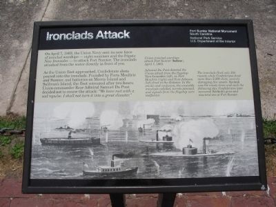
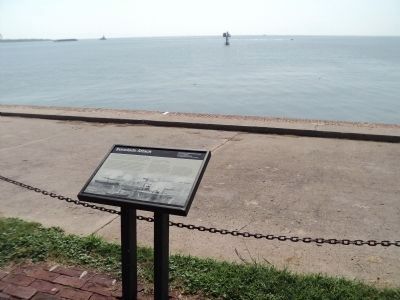
Ironclads Attack
As the Union fleet approached, Confederate shots poured onto the ironclads. Pounded by Forts Moultrie and Sumter, and batteries on Morris Island and Sullivan's Island, the fleet retreated after two hours. Union commander Rear Admiral Samuel Du Pont decided not to renew the attack: "We have met with a sad repulse. I shall not turn it into a great disaster."
(Description of drawing on the bottom of marker):
Union ironclad warships attack Fort Sumter (below), April 7, 1863.
Admiral Du Pont directed the Union attack from the flagship New Ironsides (left), as Fort Moultrie (right) and Fort Johnson (left) fired in the distance. In the smoke and confusion, the unwieldy ironclads collided, turrets jammed, and signals from the flagship were ineffective.
The ironclads fired only 154 rounds while Confederates fired more than 2,200 shots, severely damaging five vessels. Keokuk was hit ninety times and sank the following day. Confederates later recovered Keokuk's guns and mounted one at Fort Sumter.
Erected by Fort Sumter National Monument, South Carolina - National Park Service - U.S. Department of the Interior.
Topics. This historical marker is listed in this topic list: War, US Civil. A significant historical month for this entry is April 1680.
Location. 32° 45.126′ N, 79° 52.45′ W. Marker is near Charleston, South Carolina, in Charleston County. Marker is located at Fort Sumter National Monument and only reached by boat. See links below for more information about access to the site. Touch for map. Marker is in this post office area: Charleston SC 29412, United States of America. Touch for directions.
Other nearby markers. At least 8 other markers are within walking distance of this marker. Blockade Runners (a few steps from this marker); Star of the West (a few steps from this marker); Night Attack (within shouting distance of this marker); Controlling the Harbor (within shouting distance of this marker); H.L. Hunley (within shouting distance of this marker); Mountain Howitzer (within shouting distance of this marker); 8-inch (200 Pounder) Parrott (within shouting distance of this marker); Major Robert Anderson (within shouting distance of this marker). Touch for a list and map of all markers in Charleston.
Also see . . . First Battle of Charleston. Wikipedia article detailing the attack. (Submitted on May 15, 2010, by Craig Swain of Leesburg, Virginia.)

Photographed By Craig Swain, May 3, 2010
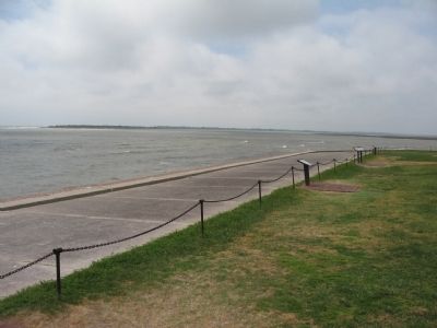
4. Mouth of the Channel at Charleston
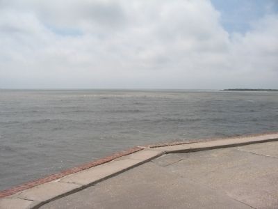
Looking toward the sea from Fort Sumter. In the distance on the right is Morris Island, which has eroded and retreated inland since the time of the war. Federal ironclads maneuvered in front of Fort Sumter during the attack. Later the Keokuk grounded off Morris Island when it sank.
Credits. This page was last revised on October 30, 2020. It was originally submitted on May 15, 2010, by Craig Swain of Leesburg, Virginia. This page has been viewed 1,049 times since then and 26 times this year. Photos: 1. submitted on May 15, 2010, by Craig Swain of Leesburg, Virginia. 2. submitted on August 4, 2013, by Bill Coughlin of Woodland Park, New Jersey. 3, 4. submitted on May 15, 2010, by Craig Swain of Leesburg, Virginia.


