Fayetteville in Cumberland County, North Carolina — The American South (South Atlantic)
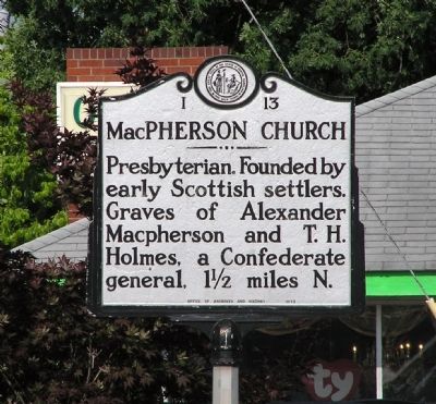
MacPherson Church
Erected 1939 by North Carolina Office of Archives and History. (Marker Number I-13.)
Topics and series. This historical marker is listed in these topic lists: Cemeteries & Burial Sites • Churches & Religion. In addition, it is included in the American Presbyterian and Reformed Historic Sites, and the North Carolina Division of Archives and History series lists.
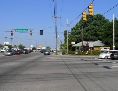
Location. 35° 2.673′ N, 78° 56.12′ W. Marker is in Fayetteville, North Carolina, in Cumberland County. Marker is on South MacPherson Church Road near Raeford Road (Business U.S. 401), on the left when traveling south. Touch for map. Marker is at or near this postal address: 3306 Raeford Road, Fayetteville NC 28303, United States of America. Touch for directions.
Other nearby markers. At least 8 other markers are within 3 miles of this marker, measured as the crow flies. John England (approx. one mile away); Saint Patrick Catholic Church (approx. 1.1 miles away); Confederate Women's Home (approx. 1.9 miles away); James C. Dobbin (approx. 1.9 miles away); Southwest Tower (1849 - 1856) (approx. 2.4 miles away); Gun Carriage and Turning Shop (1842 - 1849) (approx. 2.4 miles away); Engine House (1838 - 1848) (approx. 2.4 miles away); Fayetteville Arsenal (approx. 2.4 miles away). Touch for a list and map of all markers in Fayetteville.
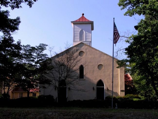
Regarding MacPherson Church. MacPherson Presbyterian Church is one of 445 American Presbyterian and Reformed Historical Sites registered between 1973 and 2003 by the Presbyterian Historical Society (PHS), headquartered in Philadelphia. Approved sites received a metal plaque featuring John Calvin’s seal and the site’s registry number (PHS marker location unknown).
The following text is taken from the Presbyterian Historical Society website:
Worship services at MacPherson Presbyterian Church began as early as 1793 on the banks of nearby Blount’s Creek. The church’s first sanctuary was built in 1808 on land deeded to the congregation by Colin McPherson, making it the first Presbyterian church in what is now Cumberland County. The church was inactive between 1854 and 1867, when the community revived the church and built a new sanctuary. The new church, built of bricks salvaged from the Fayetteville arsenal, destroyed by Sherman’s troops during the Civil War, was dedicated in 1868. Several significant pieces from the original church were incorporated into the new building, including the communion bench and the sounding board, which can be seen today in the church’s vestibule.
Credits. This page was last revised on June 25, 2021. It was originally submitted on May 17, 2010, by PaulwC3 of Northern, Virginia. This page has been viewed 957 times since then and 21 times this year. Last updated on August 18, 2018, by Douglass Halvorsen of Klamath Falls, Oregon. Photos: 1, 2, 3, 4, 5. submitted on May 17, 2010, by PaulwC3 of Northern, Virginia. • Bill Pfingsten was the editor who published this page.
